Toulouse night lights from space
Night Light of Toulouse (Occitanie) from space (France) Src. Average luminocity for 10x10km area is 96.8788% and for 50x50km: 25.3406%.
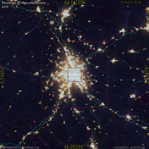
Analysis of Toulouse night lights 2016
Square area 10x10 km:
 53.79%
90-99
34.85%80-89
6.82%70-79
2.58%60-69
1.97%50-59
0%40-49
0%30-39
0%20-29
0%10-19
0%0-9
0%Square area 50x50 km:
5.06%90-99
5.33%80-89
2.85%70-79
2.52%60-69
3.31%50-59
3.4%40-49
3.71%30-39
3.33%20-29
5.65%10-19
9.66%0-9
55.18%Clear (daylight) street map image can be seen on geolist.org.
Map coordinates:
44° 6' 40.5" North, 0° 44' 25.9" East
43° 36' 15.3" North, 1° 26' 37.2" East
43° 5' 34.7" North, 2° 8' 48.4" East
Some cities around Toulouse sort by population:
• Colomiers
8.8 km =5.5 mi,  274°
274°
• Blagnac
5.1 km =3.2 mi,  308°
308°
• Balma
4.6 km =2.9 mi,  80°
80°
• Ramonville-Saint-Agne
6.9 km =4.3 mi,  158°
158°
• L'Union
7 km =4.3 mi,  26°
26°
• Saint-Jean
8 km =5 mi, 33°
• Aucamville
7.4 km =4.6 mi,  350°
350°
• Launaguet
8.3 km =5.2 mi,  6°
6°
2972315 (p: 433,055)
Sources (retrieved 2019-11-25):
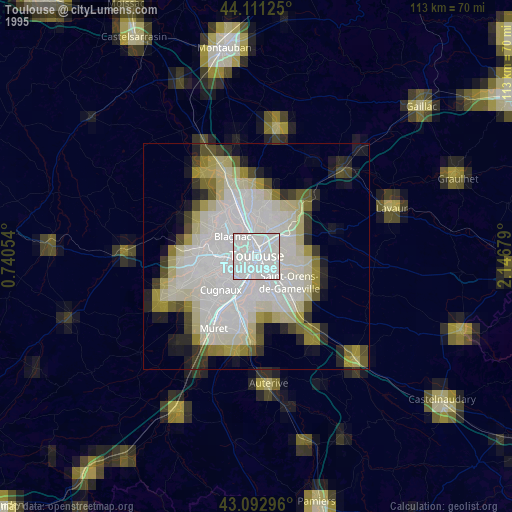
» NASA, Earths city lights 1995
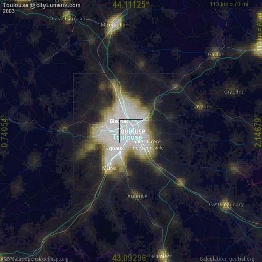
» NASA city lights 2003
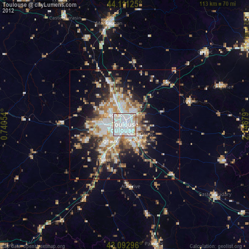
» Earth at Night: Flat Maps 2012, 2016