Valenton night lights from space
Night Light of Valenton (Île-de-France) from space (France) Src. Average luminocity for 10x10km area is 96.1503% and for 50x50km: 67.9106%.
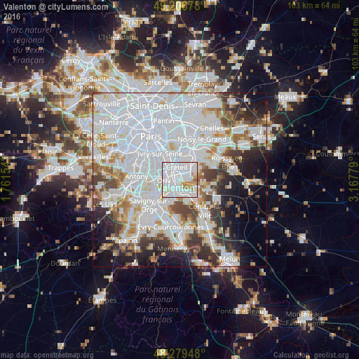
Analysis of Valenton night lights 2016
Square area 10x10 km:
 67.56%
90-99
18.75%80-89
2.98%70-79
8.78%60-69
1.64%50-59
0.3%40-49
0%30-39
0%20-29
0%10-19
0%0-9
0%Square area 50x50 km:
32.66%90-99
16.52%80-89
4.24%70-79
4.54%60-69
4.82%50-59
3.87%40-49
4.66%30-39
5.22%20-29
6.43%10-19
7.93%0-9
9.11%Clear (daylight) street map image can be seen on geolist.org.
Map coordinates:
49° 12' 24.4" North, 1° 45' 41.5" East
48° 44' 43" North, 2° 27' 52.8" East
48° 16' 46.1" North, 3° 10' 4" East
Some cities around Valenton sort by population:
• Choisy-le-Roi
4.2 km =2.6 mi,  307°
307°
• Villeneuve-Saint-Georges
1.8 km =1.1 mi,  217°
217°
• Yerres
3.7 km =2.3 mi,  145°
145°
• Limeil-Brévannes
1.6 km =1 mi,  91°
91°
• Bonneuil-sur-Marne
2.9 km =1.8 mi,  21°
21°
• Boissy-Saint-Léger
3.5 km =2.2 mi,  78°
78°
• Crosne
2.9 km =1.8 mi,  190°
190°
• Ablon-sur-Seine
3.4 km =2.1 mi,  234°
234°
2971027 (p: 11,969)
Sources (retrieved 2019-11-25):
» Earth at Night: Flat Maps 2012, 2016