Coutances night lights from space
Night Light of Coutances (Normandy) from space (France) Src. Average luminocity for 10x10km area is 7.4301% and for 50x50km: 1.561%.
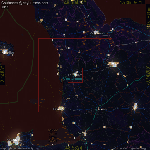
Analysis of Coutances night lights 2016
Square area 10x10 km:
 0.74%
0.74%90-99
2.53%80-89
0.3%70-79
0%60-69
0.74%50-59
2.83%40-49
0.6%30-39
0%20-29
0.6%10-19
0%0-9
91.67%Square area 50x50 km:
0.11%90-99
0.24%80-89
0.19%70-79
0.13%60-69
0.18%50-59
0.36%40-49
0.31%30-39
0.31%20-29
0.21%10-19
0.36%0-9
97.61%Clear (daylight) street map image can be seen on geolist.org.
Map coordinates:
49° 30' 14.9" North, 2° 8' 53.9" West
49° 2' 43.5" North, 1° 26' 42.6" West
48° 34' 56.6" North, 0° 44' 31.4" West
Some cities around Coutances sort by population:
• Saint Helier, JE
50.6 km =31.4 mi,  288°
288°
• Saint-Lô
27 km =16.8 mi,  73°
73°
• Vire
46.7 km =29 mi,  119°
119°
• Granville
25.6 km =15.9 mi,  205°
205°
• Avranches
40.7 km =25.3 mi,  170°
170°
• Carentan
32 km =19.9 mi,  26°
26°
• Agneaux
26 km =16.2 mi, 71°
• Le Hocq, JE
46.9 km =29.1 mi, 286°
3022826 (p: 9,657)
Sources (retrieved 2019-11-25):
» Earth at Night: Flat Maps 2012, 2016