Carentan night lights from space
Night Light of Carentan (Normandy) from space (France) Src. Average luminocity for 10x10km area is 8.7193% and for 50x50km: 2.1048%.
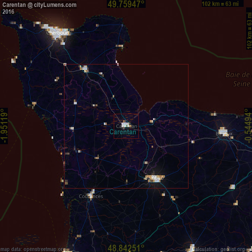
Analysis of Carentan night lights 2016
Square area 10x10 km:
 1.47%
1.47%90-99
3.34%80-89
0%70-79
0%60-69
0.53%50-59
0.94%40-49
1.2%30-39
1.07%20-29
0.4%10-19
0.4%0-9
90.64%Square area 50x50 km:
0.2%90-99
0.6%80-89
0.15%70-79
0.12%60-69
0.37%50-59
0.22%40-49
0.25%30-39
0.27%20-29
0.27%10-19
0.95%0-9
96.6%Clear (daylight) street map image can be seen on geolist.org.
Map coordinates:
49° 45' 34.1" North, 1° 57' 4.3" West
49° 18' 11.2" North, 1° 14' 53" West
48° 50' 33" North, 0° 32' 41.8" West
Some cities around Carentan sort by population:
• Saint-Lô
23.7 km =14.7 mi,  151°
151°
• Tourlaville
43.8 km =27.2 mi,  328°
328°
• Octeville
45.9 km =28.5 mi,  321°
321°
• Bayeux
39.6 km =24.6 mi,  94°
94°
• Coutances
32 km =19.9 mi,  206°
206°
• Valognes
28 km =17.4 mi, 324°
• La Glacerie
41.4 km =25.7 mi, 324°
• Agneaux
22.9 km =14.2 mi, 153°
3028610 (p: 6,950)
Sources (retrieved 2019-11-25):
» Earth at Night: Flat Maps 2012, 2016