Le Hocq night lights from space
Night Light of Le Hocq (St Clement) from space (Jersey) Src. Average luminocity for 10x10km area is 13.014% and for 50x50km: 0.8412%.
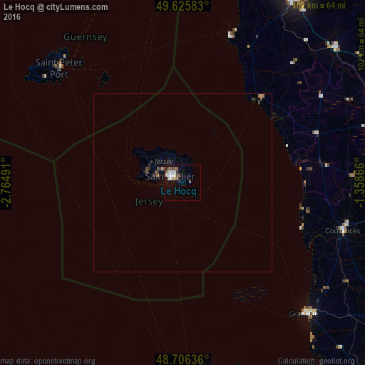
Analysis of Le Hocq night lights 2016
Square area 10x10 km:
 2.66%
2.66%90-99
2.94%80-89
1.12%70-79
0%60-69
2.94%50-59
1.82%40-49
1.12%30-39
1.26%20-29
0.98%10-19
6.16%0-9
78.99%Square area 50x50 km:
0.11%90-99
0.12%80-89
0.04%70-79
0.03%60-69
0.2%50-59
0.13%40-49
0.12%30-39
0.14%20-29
0.17%10-19
0.41%0-9
98.54%Clear (daylight) street map image can be seen on geolist.org.
Map coordinates:
49° 37' 33" North, 2° 45' 53.7" West
49° 10' 5.6" North, 2° 3' 42.4" West
48° 42' 22.9" North, 1° 21' 31.2" West
Some cities around Le Hocq sort by population:
• Saint Helier
3.8 km =2.4 mi,  305°
305°
• Saint Peter Port, GG
47.2 km =29.3 mi, 313°
• Granville, FR
50 km =31.1 mi,  137°
137°
• Coutances, FR
46.9 km =29.1 mi,  106°
106°
• Castel, GG
51.3 km =31.9 mi, 310°
• Saint Sampson, GG
48.5 km =30.1 mi,  316°
316°
• Saint Andrew, GG
48.5 km =30.1 mi, 309°
• St Martin, GG
46.6 km =29 mi, 309°
10942508 (p: 0)
Sources (retrieved 2019-11-25):
» Earth at Night: Flat Maps 2012, 2016