Neuilly-sur-Seine night lights from space
Night Light of Neuilly-sur-Seine (Île-de-France) from space (France) Src. Average luminocity for 10x10km area is 99.6577% and for 50x50km: 74.5482%.
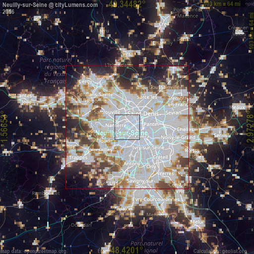
Analysis of Neuilly-sur-Seine night lights 2016
Square area 10x10 km:
 88.21%
90-99
10.51%80-89
1.28%70-79
0%60-69
0%50-59
0%40-49
0%30-39
0%20-29
0%10-19
0%0-9
0%Square area 50x50 km:
35.02%90-99
18.35%80-89
5.51%70-79
5.02%60-69
5.8%50-59
4.86%40-49
6.05%30-39
5.21%20-29
6.13%10-19
5.58%0-9
2.47%Clear (daylight) street map image can be seen on geolist.org.
Map coordinates:
49° 20' 41.4" North, 1° 33' 59.5" East
48° 53' 4.6" North, 2° 16' 10.7" East
48° 25' 12.4" North, 2° 58' 22" East
Some cities around Neuilly-sur-Seine sort by population:
• Asnières-sur-Seine
3.7 km =2.3 mi,  15°
15°
• Courbevoie
1.6 km =1 mi,  324°
324°
• Levallois-Perret
1.7 km =1.1 mi,  53°
53°
• Clichy
3.4 km =2.1 mi,  59°
59°
• Suresnes
3.3 km =2.1 mi,  243°
243°
• Puteaux
2.2 km =1.4 mi,  266°
266°
• La Garenne-Colombes
2.8 km =1.7 mi, 323°
• La Defense
2.4 km =1.5 mi,  289°
289°
2990611 (p: 61,300)
Sources (retrieved 2019-11-25):
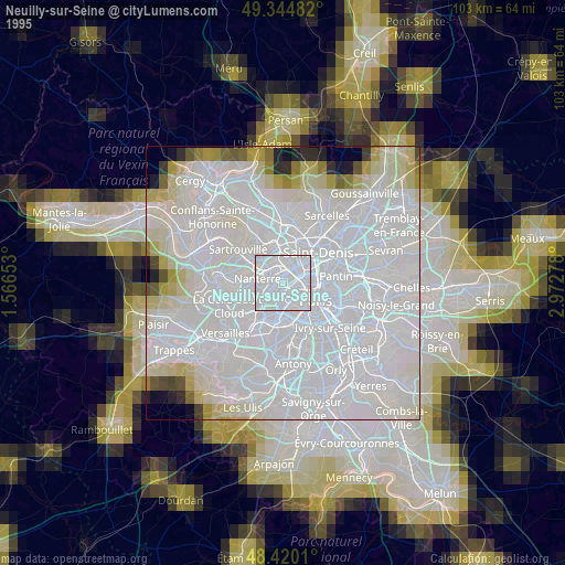
» NASA, Earths city lights 1995
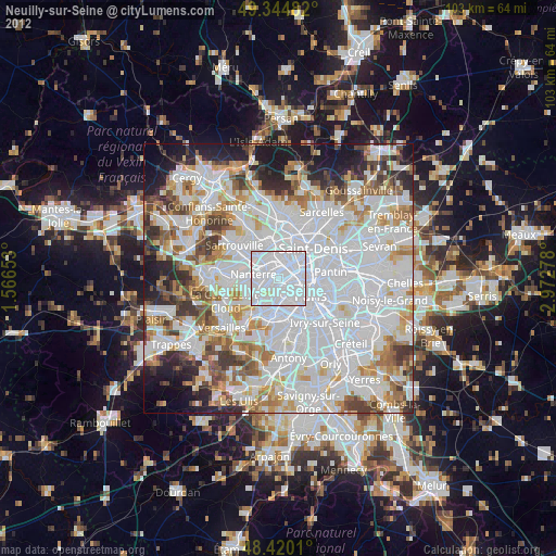
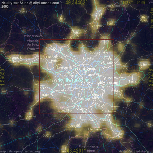
» NASA city lights 2003
» Earth at Night: Flat Maps 2012, 2016