Chamonix-Mont-Blanc night lights from space
Night Light of Chamonix-Mont-Blanc (Auvergne-Rhône-Alpes) from space (France) Src. Average luminocity for 10x10km area is 10.0074% and for 50x50km: 5.5503%.
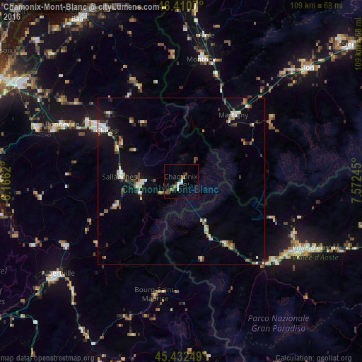
Analysis of Chamonix-Mont-Blanc night lights 2016
Square area 10x10 km:
 1.04%
1.04%90-99
2.53%80-89
0%70-79
0.6%60-69
1.79%50-59
1.19%40-49
2.68%30-39
1.34%20-29
1.34%10-19
0%0-9
87.5%Square area 50x50 km:
0.6%90-99
1%80-89
0.45%70-79
0.51%60-69
0.49%50-59
0.7%40-49
0.89%30-39
0.78%20-29
0.68%10-19
3.52%0-9
90.39%Clear (daylight) street map image can be seen on geolist.org.
Map coordinates:
46° 24' 38.5" North, 6° 9' 58.3" East
45° 55' 25.5" North, 6° 52' 9.6" East
45° 25' 57" North, 7° 34' 20.8" East
Some cities around Chamonix-Mont-Blanc sort by population:
• Cluses
27.5 km =17.1 mi,  304°
304°
• Sallanches
18.5 km =11.5 mi,  277°
277°
• Martigny-Ville, CH
25.3 km =15.7 mi,  38°
38°
• Passy
13.4 km =8.3 mi,  269°
269°
• Scionzier
28.8 km =17.9 mi, 301°
• Fully, CH
30.5 km =19 mi, 38°
• Saint-Gervais-les-Bains
12.3 km =7.6 mi,  252°
252°
• Megève
20.8 km =12.9 mi, 249°
3027301 (p: 10,614)
Sources (retrieved 2019-11-25):
» Earth at Night: Flat Maps 2012, 2016