Martigny-Ville night lights from space
Night Light of Martigny-Ville (Valais) from space (Switzerland) Src. Average luminocity for 10x10km area is 16.017% and for 50x50km: 5.0763%.
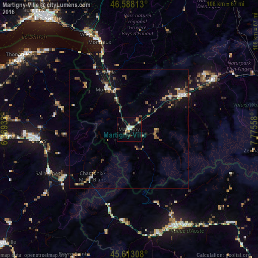
Analysis of Martigny-Ville night lights 2016
Square area 10x10 km:
 1.28%
1.28%90-99
3.84%80-89
1.7%70-79
1.7%60-69
0.57%50-59
1.99%40-49
3.84%30-39
1.56%20-29
1.42%10-19
6.68%0-9
75.43%Square area 50x50 km:
0.39%90-99
0.75%80-89
0.45%70-79
0.49%60-69
0.66%50-59
0.86%40-49
0.96%30-39
0.88%20-29
0.56%10-19
3.5%0-9
90.5%Clear (daylight) street map image can be seen on geolist.org.
Map coordinates:
46° 35' 17.3" North, 6° 22' 9.6" East
46° 6' 9.9" North, 7° 4' 20.8" East
45° 36' 47.1" North, 7° 46' 32.1" East
Some cities around Martigny-Ville sort by population:
• Monthey
19.2 km =11.9 mi,  331°
331°
• Ollon
22.3 km =13.9 mi,  344°
344°
• Conthey
22.3 km =13.9 mi,  52°
52°
• Bagnes
11.3 km =7 mi,  100°
100°
• Bex
17 km =10.6 mi, 343°
• Collombey
21.3 km =13.2 mi, 333°
• Fully
5.1 km =3.2 mi,  39°
39°
• Basse-Nendaz
20.9 km =13 mi,  62°
62°
2659748 (p: 14,768)
Sources (retrieved 2019-11-25):
» Earth at Night: Flat Maps 2012, 2016