Châlette-sur-Loing night lights from space
Night Light of Châlette-sur-Loing (Centre) from space (France) Src. Average luminocity for 10x10km area is 39.1463% and for 50x50km: 3.204%.
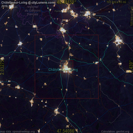
Analysis of Châlette-sur-Loing night lights 2016
Square area 10x10 km:
 3.69%
3.69%90-99
8.38%80-89
4.83%70-79
3.55%60-69
6.25%50-59
9.8%40-49
6.39%30-39
3.98%20-29
9.38%10-19
30.68%0-9
13.07%Square area 50x50 km:
0.19%90-99
0.41%80-89
0.3%70-79
0.31%60-69
0.65%50-59
0.75%40-49
0.6%30-39
0.47%20-29
0.59%10-19
2.25%0-9
93.48%Clear (daylight) street map image can be seen on geolist.org.
Map coordinates:
48° 28' 53.7" North, 2° 1' 57.9" East
48° 0' 48.1" North, 2° 44' 9.1" East
47° 32' 27.1" North, 3° 26' 20.4" East
Some cities around Châlette-sur-Loing sort by population:
• Montargis
1.8 km =1.1 mi,  187°
187°
• Gien
36.4 km =22.6 mi, 192°
• Nemours
29.3 km =18.2 mi,  353°
353°
• Amilly
5.2 km =3.2 mi,  149°
149°
• Villemandeur
3.2 km =2 mi,  204°
204°
• Saint-Pierre-lès-Nemours
28.5 km =17.7 mi, 351°
• Sully-sur-Loire
38.8 km =24.1 mi,  224°
224°
• Souppes-sur-Loing
18.9 km =11.7 mi,  359°
359°
3027531 (p: 14,268)
Sources (retrieved 2019-11-25):
» Earth at Night: Flat Maps 2012, 2016