Beynes night lights from space
Night Light of Beynes (Île-de-France) from space (France) Src. Average luminocity for 10x10km area is 28.929% and for 50x50km: 37.3967%.
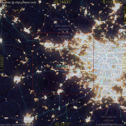
Analysis of Beynes night lights 2016
Square area 10x10 km:
 1.56%
1.56%90-99
2.41%80-89
2.13%70-79
3.98%60-69
6.25%50-59
4.26%40-49
6.11%30-39
4.4%20-29
10.09%10-19
49.29%0-9
9.52%Square area 50x50 km:
8.97%90-99
9.2%80-89
3.8%70-79
3.8%60-69
4.44%50-59
3.99%40-49
5.6%30-39
4.43%20-29
6.94%10-19
11.79%0-9
37.05%Clear (daylight) street map image can be seen on geolist.org.
Map coordinates:
49° 19' 0.3" North, 1° 10' 10.2" East
48° 51' 22.5" North, 1° 52' 21.4" East
48° 23' 29.4" North, 2° 34' 32.7" East
Some cities around Beynes sort by population:
• Plaisir
7 km =4.3 mi,  121°
121°
• Élancourt
10 km =6.2 mi,  142°
142°
• Maurepas
11 km =6.8 mi,  157°
157°
• Les Clayes-sous-Bois
9.2 km =5.7 mi,  114°
114°
• Villepreux
9.7 km =6 mi, 108°
• Maule
6.2 km =3.9 mi,  346°
346°
• Orgeval
10.6 km =6.6 mi,  46°
46°
• Jouars-Pontchartrain
7.7 km =4.8 mi,  165°
165°
3032872 (p: 7,914)
Sources (retrieved 2019-11-25):
» Earth at Night: Flat Maps 2012, 2016