Besançon night lights from space
Night Light of Besançon (Bourgogne-Franche-Comté) from space (France) Src. Average luminocity for 10x10km area is 52.3973% and for 50x50km: 4.6409%.
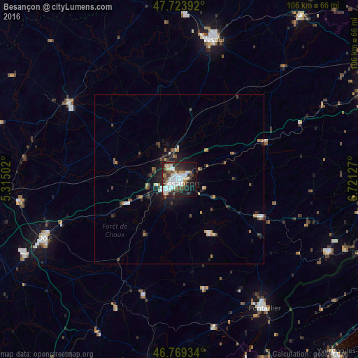
Analysis of Besançon night lights 2016
Square area 10x10 km:
 15.48%
90-99
13.99%80-89
2.98%70-79
2.83%60-69
6.1%50-59
4.91%40-49
6.1%30-39
7.59%20-29
15.48%10-19
19.2%0-9
5.36%Square area 50x50 km:
0.81%90-99
0.72%80-89
0.3%70-79
0.51%60-69
0.51%50-59
0.46%40-49
0.82%30-39
0.79%20-29
1.37%10-19
3.05%0-9
90.65%Clear (daylight) street map image can be seen on geolist.org.
Map coordinates:
47° 43' 26.1" North, 5° 18' 54.1" East
47° 14' 55.6" North, 6° 1' 5.3" East
46° 46' 9.6" North, 6° 43' 16.6" East
Some cities around Besançon sort by population:
• Dole
43.6 km =27.1 mi,  246°
246°
• Pontarlier
46.1 km =28.6 mi,  146°
146°
• Vesoul
43 km =26.7 mi,  12°
12°
• Auxonne
48.1 km =29.9 mi,  262°
262°
• Gray
38.9 km =24.2 mi,  304°
304°
• Morteau
49.3 km =30.6 mi,  115°
115°
• Baume-les-Dames
28.3 km =17.6 mi,  65°
65°
• Valdahon
27.4 km =17 mi,  113°
113°
3033123 (p: 128,426)
Sources (retrieved 2019-11-25):
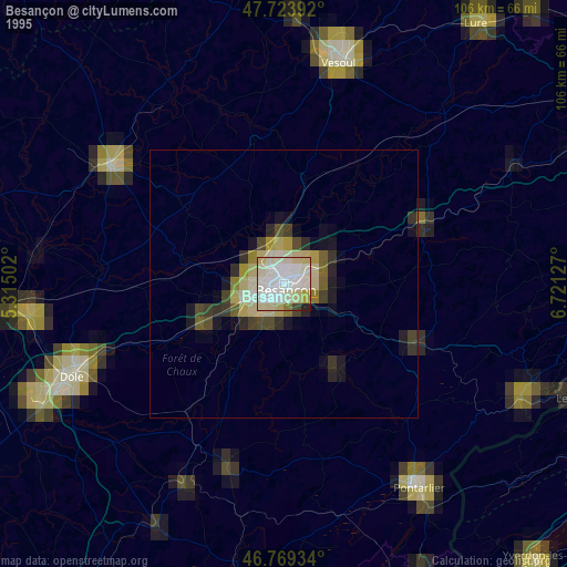
» NASA, Earths city lights 1995
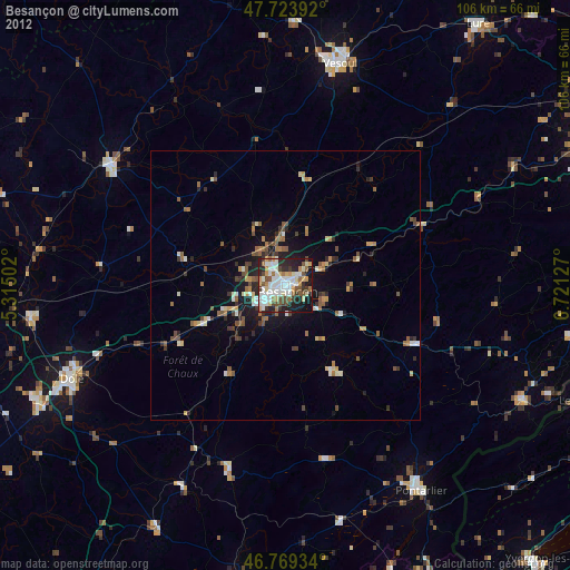
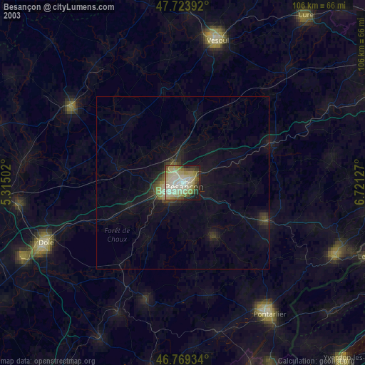
» NASA city lights 2003
» Earth at Night: Flat Maps 2012, 2016