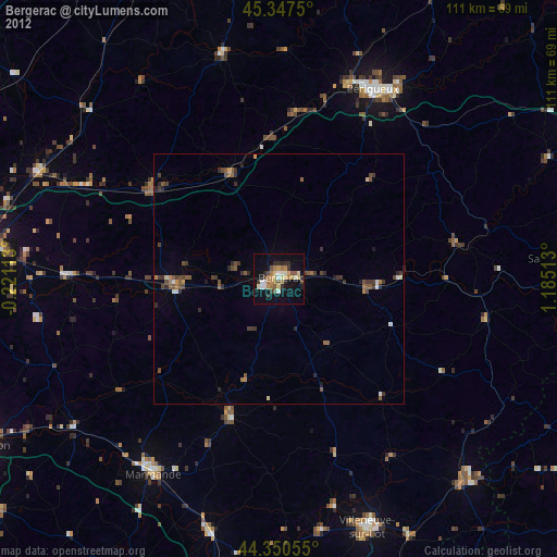
Bergerac night lights from space
Night Light of Bergerac (Nouvelle-Aquitaine) from space (France) Src. Average luminocity for 10x10km area is 25.6492% and for 50x50km: 2.7787%.
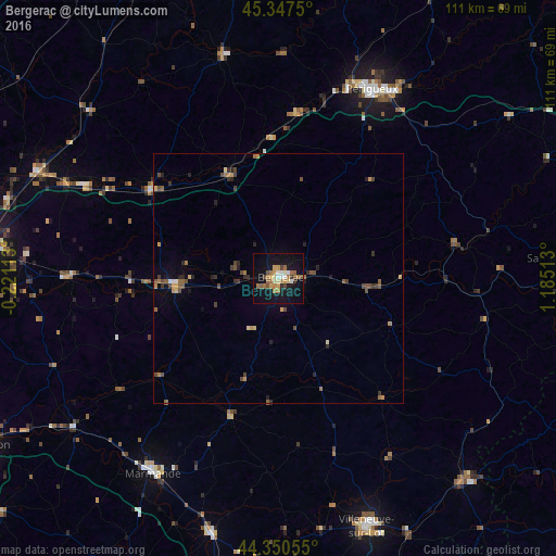
Analysis of Bergerac night lights 2016
Square area 10x10 km:
 2.06%
2.06%90-99
2.86%80-89
3.02%70-79
4.29%60-69
7.3%50-59
3.81%40-49
3.02%30-39
1.59%20-29
0.63%10-19
29.21%0-9
42.22%Square area 50x50 km:
0.11%90-99
0.19%80-89
0.28%70-79
0.41%60-69
0.57%50-59
0.56%40-49
0.66%30-39
0.47%20-29
0.6%10-19
1.41%0-9
94.74%Clear (daylight) street map image can be seen on geolist.org.
Map coordinates:
45° 20' 51" North, 0° 13' 16.1" West
44° 51' 4.2" North, 0° 28' 55.2" East
44° 21' 2" North, 1° 11' 6.5" East
Some cities around Bergerac sort by population:
• Périgueux
41.3 km =25.7 mi,  26°
26°
• Villeneuve-sur-Lot
52.3 km =32.5 mi,  160°
160°
• Marmande
46.4 km =28.8 mi,  212°
212°
• Coulounieix-Chamiers
37.3 km =23.2 mi, 25°
• Trélissac
45.3 km =28.1 mi, 31°
• Boulazac
36.3 km =22.6 mi,  35°
35°
• Sainte-Livrade-sur-Lot
51 km =31.7 mi,  170°
170°
• Montpon-Ménestérol
29.8 km =18.5 mi,  303°
303°
3033391 (p: 28,317)
Sources (retrieved 2019-11-25):
» Earth at Night: Flat Maps 2012, 2016