Marmande night lights from space
Night Light of Marmande (Nouvelle-Aquitaine) from space (France) Src. Average luminocity for 10x10km area is 16.8429% and for 50x50km: 2.3738%.
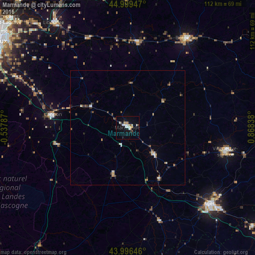
Analysis of Marmande night lights 2016
Square area 10x10 km:
 2.7%
2.7%90-99
3.65%80-89
2.54%70-79
1.9%60-69
0.63%50-59
0.63%40-49
0.63%30-39
2.06%20-29
1.75%10-19
9.52%0-9
73.97%Square area 50x50 km:
0.2%90-99
0.4%80-89
0.22%70-79
0.3%60-69
0.21%50-59
0.47%40-49
0.4%30-39
0.36%20-29
0.54%10-19
0.54%0-9
96.37%Clear (daylight) street map image can be seen on geolist.org.
Map coordinates:
44° 59' 58.1" North, 0° 32' 16.3" West
44° 30' 0.4" North, 0° 9' 54.9" East
43° 59' 47.3" North, 0° 52' 6.2" East
Some cities around Marmande sort by population:
• Bergerac
46.4 km =28.8 mi,  32°
32°
• Villeneuve-sur-Lot
44 km =27.3 mi,  103°
103°
• Tonneins
16.8 km =10.4 mi,  135°
135°
• Nérac
42.8 km =26.6 mi,  161°
161°
• Langon
33.4 km =20.8 mi,  280°
280°
• Sainte-Livrade-sur-Lot
35.6 km =22.1 mi,  108°
108°
• Bazas
31 km =19.3 mi,  255°
255°
• Casteljaloux
21.2 km =13.2 mi,  197°
197°
2995642 (p: 19,069)
Sources (retrieved 2019-11-25):
» Earth at Night: Flat Maps 2012, 2016