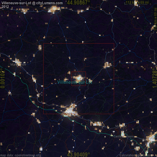
Villeneuve-sur-Lot night lights from space
Night Light of Villeneuve-sur-Lot (Nouvelle-Aquitaine) from space (France) Src. Average luminocity for 10x10km area is 24.2317% and for 50x50km: 3.574%.
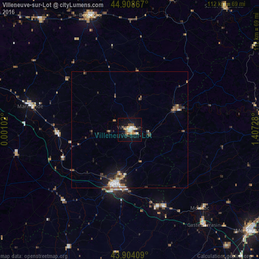
Analysis of Villeneuve-sur-Lot night lights 2016
Square area 10x10 km:
 2.7%
2.7%90-99
4.29%80-89
4.13%70-79
3.49%60-69
2.54%50-59
1.75%40-49
4.44%30-39
0.32%20-29
2.22%10-19
25.71%0-9
48.41%Square area 50x50 km:
0.42%90-99
0.56%80-89
0.26%70-79
0.46%60-69
0.49%50-59
0.49%40-49
0.54%30-39
0.42%20-29
1.21%10-19
2.37%0-9
92.78%Clear (daylight) street map image can be seen on geolist.org.
Map coordinates:
44° 54' 31.2" North, 0° 0' 3.7" East
44° 24' 30.7" North, 0° 42' 14.9" East
43° 54' 14.7" North, 1° 24' 26.2" East
Some cities around Villeneuve-sur-Lot sort by population:
• Agen
24 km =14.9 mi,  194°
194°
• Tonneins
31.2 km =19.4 mi,  266°
266°
• Le Passage
24.4 km =15.2 mi,  199°
199°
• Sainte-Livrade-sur-Lot
9 km =5.6 mi,  263°
263°
• Bon-Encontre
25 km =15.5 mi, 186°
• Fumel
23 km =14.3 mi,  64°
64°
• Foulayronnes
19.3 km =12 mi, 194°
• Valence
36.6 km =22.7 mi,  155°
155°
2968515 (p: 25,869)
Sources (retrieved 2019-11-25):
» Earth at Night: Flat Maps 2012, 2016