Bagnères-de-Bigorre night lights from space
Night Light of Bagnères-de-Bigorre (Occitanie) from space (France) Src. Average luminocity for 10x10km area is 6.4905% and for 50x50km: 4.4865%.
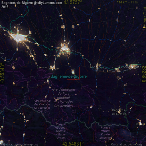
Analysis of Bagnères-de-Bigorre night lights 2016
Square area 10x10 km:
 0.16%
0.16%90-99
1.11%80-89
1.11%70-79
0.79%60-69
0.48%50-59
1.27%40-49
0.48%30-39
0.63%20-29
4.76%10-19
0.63%0-9
88.57%Square area 50x50 km:
0.24%90-99
0.62%80-89
0.46%70-79
0.55%60-69
0.65%50-59
0.86%40-49
0.92%30-39
0.85%20-29
1.44%10-19
2.3%0-9
91.11%Clear (daylight) street map image can be seen on geolist.org.
Map coordinates:
43° 34' 32.5" North, 0° 33' 12.3" West
43° 3' 51" North, 0° 8' 58.9" East
42° 32' 53.9" North, 0° 51' 10.2" East
Some cities around Bagnères-de-Bigorre sort by population:
• Tarbes
19.6 km =12.2 mi,  344°
344°
• Lourdes
16.7 km =10.4 mi,  283°
283°
• Saint-Gaudens
46.8 km =29.1 mi,  84°
84°
• Aureilhan
20.4 km =12.7 mi,  347°
347°
• Lannemezan
20.2 km =12.6 mi,  70°
70°
• Vic-en-Bigorre
36.7 km =22.8 mi, 347°
• Gan
47.2 km =29.3 mi,  293°
293°
• Bizanos
47.3 km =29.4 mi,  301°
301°
3035418 (p: 8,967)
Sources (retrieved 2019-11-25):
» Earth at Night: Flat Maps 2012, 2016