Vic-en-Bigorre night lights from space
Night Light of Vic-en-Bigorre (Occitanie) from space (France) Src. Average luminocity for 10x10km area is 3.8698% and for 50x50km: 3.8768%.
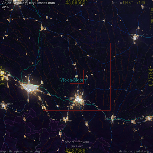
Analysis of Vic-en-Bigorre night lights 2016
Square area 10x10 km:
 0%
0%90-99
0%80-89
0%70-79
1.9%60-69
0.63%50-59
0.63%40-49
0%30-39
1.9%20-29
1.27%10-19
0%0-9
93.65%Square area 50x50 km:
0.22%90-99
0.48%80-89
0.32%70-79
0.66%60-69
0.63%50-59
0.56%40-49
0.9%30-39
0.75%20-29
1.12%10-19
2.44%0-9
91.92%Clear (daylight) street map image can be seen on geolist.org.
Map coordinates:
43° 53' 44.3" North, 0° 38' 54.3" West
43° 23' 12.6" North, 0° 3' 17" East
42° 52' 25.2" North, 0° 45' 28.2" East
Some cities around Vic-en-Bigorre sort by population:
• Pau
35.4 km =22 mi,  254°
254°
• Tarbes
17.2 km =10.7 mi,  172°
172°
• Lourdes
33 km =20.5 mi,  194°
194°
• Lons
37.6 km =23.4 mi,  258°
258°
• Bagnères-de-Bigorre
36.7 km =22.8 mi, 167°
• Aureilhan
16.3 km =10.1 mi, 168°
• Jurançon
37.4 km =23.2 mi, 252°
• Bizanos
34.7 km =21.6 mi, 250°
2969401 (p: 5,375)
Sources (retrieved 2019-11-25):
» Earth at Night: Flat Maps 2012, 2016