Annonay night lights from space
Night Light of Annonay (Auvergne-Rhône-Alpes) from space (France) Src. Average luminocity for 10x10km area is 18.7561% and for 50x50km: 9.2799%.
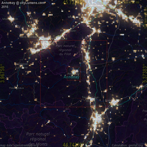
Analysis of Annonay night lights 2016
Square area 10x10 km:
 3.03%
3.03%90-99
3.33%80-89
1.82%70-79
2.88%60-69
0.76%50-59
1.82%40-49
3.64%30-39
1.82%20-29
1.52%10-19
14.85%0-9
64.55%Square area 50x50 km:
1.35%90-99
1.72%80-89
0.75%70-79
0.95%60-69
0.88%50-59
1.08%40-49
1.39%30-39
1.06%20-29
2.45%10-19
8.27%0-9
80.09%Clear (daylight) street map image can be seen on geolist.org.
Map coordinates:
45° 43' 58.3" North, 3° 58' 3.3" East
45° 14' 23.7" North, 4° 40' 14.5" East
44° 44' 33.6" North, 5° 22' 25.8" East
Some cities around Annonay sort by population:
• Saint-Chamond
29 km =18 mi,  334°
334°
• Tournon-sur-Rhône
23.1 km =14.4 mi,  146°
146°
• Roussillon
18.7 km =11.6 mi,  37°
37°
• La Ricamarie
29.9 km =18.6 mi,  307°
307°
• Le Péage-de-Roussillon
17.9 km =11.1 mi,  33°
33°
• Saint-Jean-Bonnefonds
29.9 km =18.6 mi,  323°
323°
• Tain-l’Hermitage
24.1 km =15 mi,  142°
142°
• La Grand-Croix
30.6 km =19 mi,  343°
343°
3037514 (p: 18,423)
Sources (retrieved 2019-11-25):
» Earth at Night: Flat Maps 2012, 2016