Orimattila night lights from space
Night Light of Orimattila (Päijänne Tavastia) from space (Finland) Src. Average luminocity for 10x10km area is 20.1851% and for 50x50km: 12.2151%.
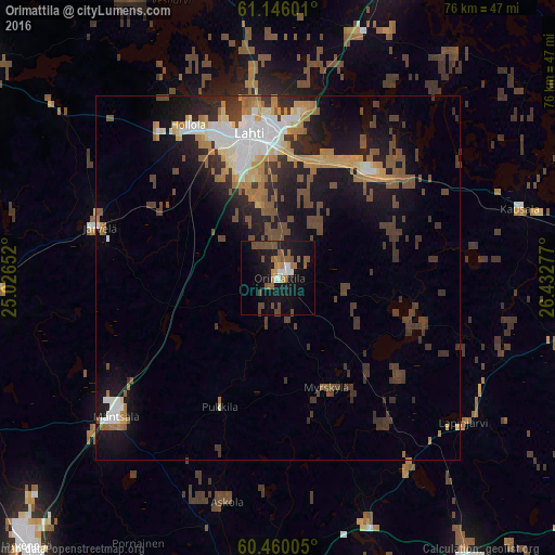
Analysis of Orimattila night lights 2016
Square area 10x10 km:
 2.49%
2.49%90-99
1.41%80-89
0.11%70-79
2.49%60-69
3.57%50-59
6.39%40-49
6.06%30-39
0%20-29
1.41%10-19
25.65%0-9
50.43%Square area 50x50 km:
1.45%90-99
1.92%80-89
0.88%70-79
1.72%60-69
1.9%50-59
1.83%40-49
2.58%30-39
2.52%20-29
2.5%10-19
8.72%0-9
73.97%Clear (daylight) street map image can be seen on geolist.org.
Map coordinates:
61° 8' 45.6" North, 25° 1' 35.5" East
60° 48' 17.5" North, 25° 43' 46.7" East
60° 27' 36.2" North, 26° 25' 58" East
Some cities around Orimattila sort by population:
• Lahti
20.1 km =12.5 mi,  349°
349°
• Porvoo
46 km =28.6 mi,  184°
184°
• Hollola
31.6 km =19.6 mi,  329°
329°
• Mäntsälä
29.5 km =18.3 mi,  229°
229°
• Nastola
19.5 km =12.1 mi,  34°
34°
• Elimäki
41.2 km =25.6 mi,  103°
103°
• Hausjärvi
43.3 km =26.9 mi,  266°
266°
• Iitti
34.5 km =21.4 mi,  73°
73°
643644 (p: 14,603)
Sources (retrieved 2019-11-25):
» Earth at Night: Flat Maps 2012, 2016