Hausjärvi night lights from space
Night Light of Hausjärvi (Kanta-Hame) from space (Finland) Src. Average luminocity for 10x10km area is 3.1223% and for 50x50km: 6.9064%.
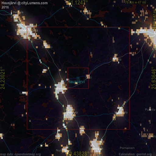
Analysis of Hausjärvi night lights 2016
Square area 10x10 km:
 0%
0%90-99
0.22%80-89
0.22%70-79
0.87%60-69
0.54%50-59
0.87%40-49
0.54%30-39
0.22%20-29
0.22%10-19
0.87%0-9
95.45%Square area 50x50 km:
1.31%90-99
1.58%80-89
0.52%70-79
0.48%60-69
0.86%50-59
0.96%40-49
0.16%30-39
0.23%20-29
1.81%10-19
6.11%0-9
85.99%Clear (daylight) street map image can be seen on geolist.org.
Map coordinates:
61° 7' 28.9" North, 24° 13' 48.8" East
60° 46' 60" North, 24° 55' 60" East
60° 26' 17.8" North, 25° 38' 11.3" East
Some cities around Hausjärvi sort by population:
• Hämeenlinna
34.7 km =21.6 mi,  312°
312°
• Hyvinge
17.1 km =10.6 mi,  192°
192°
• Järvenpää
35.5 km =22.1 mi,  166°
166°
• Riihimäki
9.9 km =6.2 mi,  239°
239°
• Mäntsälä
26.7 km =16.6 mi,  128°
128°
• Janakkala
22.2 km =13.8 mi, 305°
• Loppi
27.3 km =17 mi,  254°
254°
• Lammi
33.7 km =20.9 mi,  7°
7°
658581 (p: 8,151)
Sources (retrieved 2019-11-25):
» Earth at Night: Flat Maps 2012, 2016