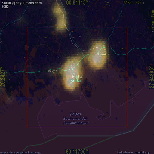
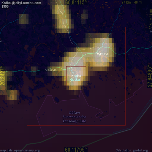
Kotka night lights from space
Night Light of Kotka (Kymenlaakso) from space (Finland) Src. Average luminocity for 10x10km area is 58.8626% and for 50x50km: 9.509%.


Analysis of Kotka night lights 2016
Square area 10x10 km:
 18.49%
90-99
20.25%80-89
4.65%70-79
6.3%60-69
3.93%50-59
0.93%40-49
3.72%30-39
5.27%20-29
13.22%10-19
12.4%0-9
10.85%Square area 50x50 km:
1.24%90-99
1.79%80-89
1.15%70-79
0.87%60-69
1.38%50-59
1.46%40-49
1.43%30-39
0.96%20-29
2.56%10-19
7.03%0-9
80.13%Clear (daylight) street map image can be seen on geolist.org.
Map coordinates:
60° 48' 40.1" North, 26° 14' 33.7" East
60° 27' 59" North, 26° 56' 45" East
60° 7' 4.6" North, 27° 38' 56.2" East
Some cities around Kotka sort by population:
• Kouvola
46.5 km =28.9 mi,  343°
343°
• Karhula
6.2 km =3.9 mi,  352°
352°
• Hamina
18 km =11.2 mi,  50°
50°
• Anjala
24.9 km =15.5 mi, 345°
• Lovisa
39.5 km =24.5 mi,  268°
268°
• Elimäki
38.2 km =23.7 mi,  316°
316°
• Iitti
58 km =36 mi,  325°
325°
• Luumäki
61.7 km =38.3 mi,  34°
34°
650946 (p: 54,616)
Sources (retrieved 2019-11-25):
» NASA, Earths city lights 1995
» NASA city lights 2003
» Earth at Night: Flat Maps 2012, 2016