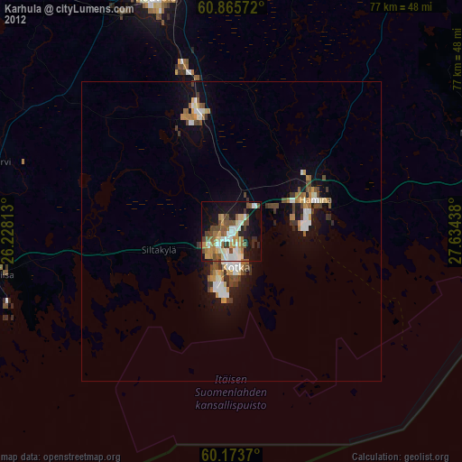
Karhula night lights from space
Night Light of Karhula (Kymenlaakso) from space (Finland) Src. Average luminocity for 10x10km area is 51.3864% and for 50x50km: 10.7174%.
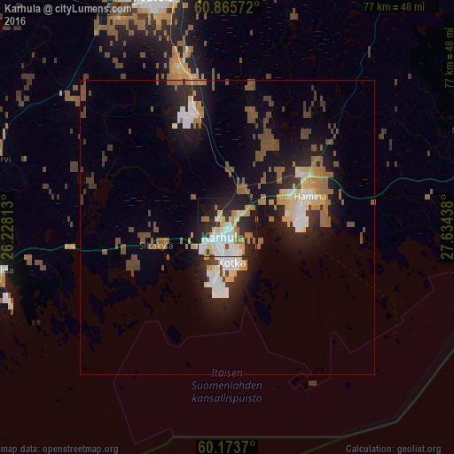
Analysis of Karhula night lights 2016
Square area 10x10 km:
 10.95%
90-99
14.88%80-89
7.85%70-79
5.79%60-69
6.82%50-59
0.41%40-49
0.72%30-39
4.86%20-29
19.63%10-19
24.17%0-9
3.93%Square area 50x50 km:
1.34%90-99
1.89%80-89
1.2%70-79
0.98%60-69
1.63%50-59
1.78%40-49
1.73%30-39
1.18%20-29
3.13%10-19
7.66%0-9
77.49%Clear (daylight) street map image can be seen on geolist.org.
Map coordinates:
60° 51' 56.6" North, 26° 13' 41.3" East
60° 31' 17.6" North, 26° 55' 52.5" East
60° 10' 25.3" North, 27° 38' 3.8" East
Some cities around Karhula sort by population:
• Kotka
6.2 km =3.9 mi,  172°
172°
• Kouvola
40.4 km =25.1 mi,  341°
341°
• Hamina
15.5 km =9.6 mi,  69°
69°
• Anjala
18.8 km =11.7 mi, 343°
• Lovisa
39.3 km =24.4 mi,  259°
259°
• Elimäki
33.4 km =20.8 mi,  310°
310°
• Iitti
52.6 km =32.7 mi,  322°
322°
• Luumäki
57.2 km =35.5 mi,  38°
38°
654137 (p: 22,867)
Sources (retrieved 2019-11-25):
» Earth at Night: Flat Maps 2012, 2016