Kerimäki night lights from space
Night Light of Kerimäki (South Savo) from space (Finland) Src. Average luminocity for 10x10km area is 3.9275% and for 50x50km: 2.6869%.
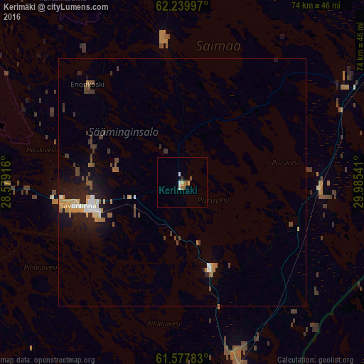
Analysis of Kerimäki night lights 2016
Square area 10x10 km:
 0.62%
0.62%90-99
0.62%80-89
0.83%70-79
0%60-69
0.62%50-59
0.93%40-49
0.52%30-39
0.21%20-29
0.21%10-19
0%0-9
95.45%Square area 50x50 km:
0.27%90-99
0.33%80-89
0.27%70-79
0.43%60-69
0.36%50-59
0.33%40-49
0.5%30-39
0.41%20-29
0.43%10-19
2.32%0-9
94.34%Clear (daylight) street map image can be seen on geolist.org.
Map coordinates:
62° 14' 23.9" North, 28° 34' 45" East
61° 54' 38.5" North, 29° 16' 56.2" East
61° 34' 40.2" North, 29° 59' 7.5" East
Some cities around Kerimäki sort by population:
• Savonlinna
21.6 km =13.4 mi,  257°
257°
• Sortavala, RU
78.1 km =48.5 mi,  106°
106°
• Liperi
69.4 km =43.1 mi,  3°
3°
• Kitee
49.9 km =31 mi,  65°
65°
• Lakhdenpokh’ya, RU
65 km =40.4 mi,  131°
131°
• Pyhäselkä
68.1 km =42.3 mi,  31°
31°
• Juva
75 km =46.6 mi,  269°
269°
• Ruokolahti
73.7 km =45.8 mi,  198°
198°
653180 (p: 5,841)
Sources (retrieved 2019-11-25):
» Earth at Night: Flat Maps 2012, 2016