Vic night lights from space
Night Light of Vic (Catalonia) from space (Spain) Src. Average luminocity for 10x10km area is 33.4222% and for 50x50km: 6.5113%.
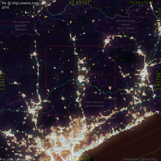
Analysis of Vic night lights 2016
Square area 10x10 km:
100  6.51%
6.51%
90-99 7.62%
80-89 4.76%
70-79 1.75%
60-69 2.06%
50-59 1.11%
40-49 2.7%
30-39 3.17%
20-29 13.97%
10-19 39.52%
0-9 16.83%
6.51%90-99
7.62%80-89
4.76%70-79
1.75%60-69
2.06%50-59
1.11%40-49
2.7%30-39
3.17%20-29
13.97%10-19
39.52%0-9
16.83%Square area 50x50 km:
100 0.61%
90-99 0.87%
80-89 0.69%
70-79 0.66%
60-69 0.6%
50-59 0.99%
40-49 0.86%
30-39 0.67%
20-29 1.78%
10-19 6.87%
0-9 85.41%
0.61%90-99
0.87%80-89
0.69%70-79
0.66%60-69
0.6%50-59
0.99%40-49
0.86%30-39
0.67%20-29
1.78%10-19
6.87%0-9
85.41%Clear (daylight) street map image can be seen on geolist.org.
Map coordinates:
42° 27' 3.9" North, 1° 33' 6.2" East
41° 55' 48.4" North, 2° 15' 17.5" East
41° 24' 17.6" North, 2° 57' 28.7" East
Some cities around Vic sort by population:
• Manlleu
8.4 km =5.2 mi,  17°
17°
• Vilaseca
14.6 km =9.1 mi,  0°
0°
• la Garriga
27.5 km =17.1 mi,  175°
175°
• Torelló
13 km =8.1 mi, 4°
• Tona
9.4 km =5.8 mi,  193°
193°
• Centelles
15 km =9.3 mi, 191°
• Taradell
6.7 km =4.2 mi,  156°
156°
• Moià
18.5 km =11.5 mi,  224°
224°
3106050 (p: 39,844)
Sources (retrieved 2019-11-25):
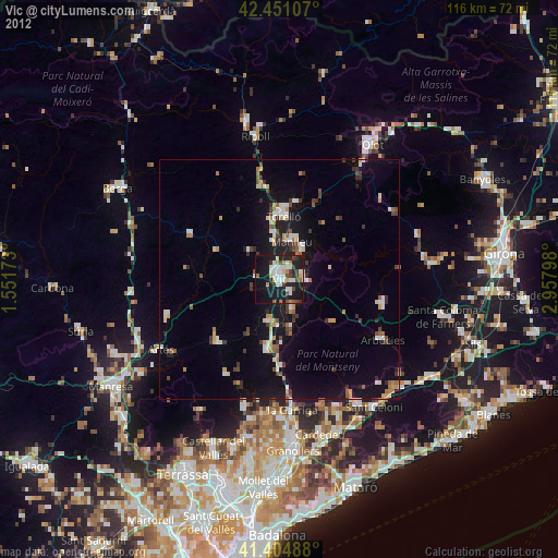
» Earth at Night: Flat Maps 2012, 2016