Rianxo night lights from space
Night Light of Rianxo (Galicia) from space (Spain) Src. Average luminocity for 10x10km area is 33.5939% and for 50x50km: 22.1837%.
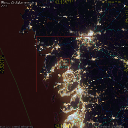
Analysis of Rianxo night lights 2016
Square area 10x10 km:
 0.91%
0.91%90-99
4.85%80-89
3.64%70-79
2.73%60-69
5.91%50-59
5%40-49
8.79%30-39
3.94%20-29
20.45%10-19
39.24%0-9
4.55%Square area 50x50 km:
1.52%90-99
3.69%80-89
2.47%70-79
2.69%60-69
3.57%50-59
3.72%40-49
3.55%30-39
4.31%20-29
8.17%10-19
16.04%0-9
50.27%Clear (daylight) street map image can be seen on geolist.org.
Map coordinates:
43° 9' 53.2" North, 9° 31' 14.7" West
42° 38' 59.2" North, 8° 49' 3.5" West
42° 7' 49.7" North, 8° 6' 52.2" West
Some cities around Rianxo sort by population:
• Vilagarcía de Arousa
7.4 km =4.6 mi,  143°
143°
• Boiro
5.5 km =3.4 mi,  267°
267°
• Cambados
15.3 km =9.5 mi,  178°
178°
• Vilanova de Arousa
9.6 km =6 mi,  185°
185°
• Caldas de Reis
15.2 km =9.4 mi,  109°
109°
• A Pobra do Caramiñal
11.2 km =7 mi,  242°
242°
• Valga
15.5 km =9.6 mi,  69°
69°
• Illa de Arousa
10.6 km =6.6 mi,  205°
205°
3111879 (p: 11,769)
Sources (retrieved 2019-11-25):
» Earth at Night: Flat Maps 2012, 2016