City Center night lights from space
Night Light of City Center (Madrid) from space (Spain) Src. Average luminocity for 10x10km area is 97.9371% and for 50x50km: 56.8742%.
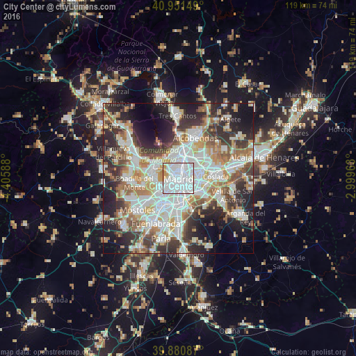
Analysis of City Center night lights 2016
Square area 10x10 km:
 71.94%
90-99
21.26%80-89
0.68%70-79
5.44%60-69
0.68%50-59
0%40-49
0%30-39
0%20-29
0%10-19
0%0-9
0%Square area 50x50 km:
16.02%90-99
14.37%80-89
5.15%70-79
6.79%60-69
6.52%50-59
5.98%40-49
5.65%30-39
7.48%20-29
12.09%10-19
11.44%0-9
8.51%Clear (daylight) street map image can be seen on geolist.org.
Map coordinates:
40° 57' 5.4" North, 4° 24' 21.2" West
40° 25' 5.9" North, 3° 42' 9.9" West
39° 52' 51.1" North, 2° 59' 58.7" West
Some cities around City Center sort by population:
• Madrid
0.2 km =0.1 mi,  175°
175°
• Carabanchel
3.5 km =2.2 mi,  210°
210°
• Arganzuela
2.1 km =1.3 mi,  164°
164°
• Salamanca
2.3 km =1.4 mi,  56°
56°
• Chamberí
1.8 km =1.1 mi,  357°
357°
• Usera
3.3 km =2.1 mi, 176°
• Retiro
1.8 km =1.1 mi,  108°
108°
• Moncloa-Aravaca
3.1 km =1.9 mi,  307°
307°
6544494 (p: 149,718)
Sources (retrieved 2019-11-25):
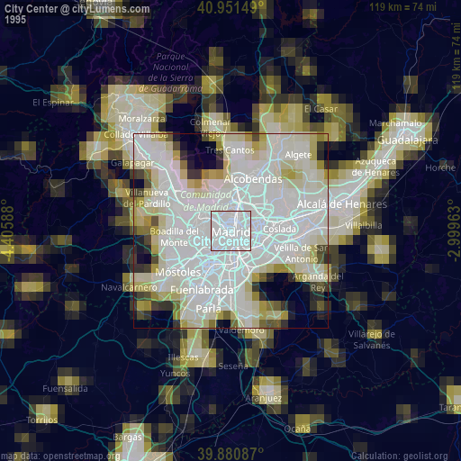
» NASA, Earths city lights 1995
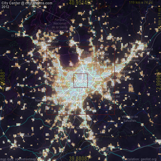
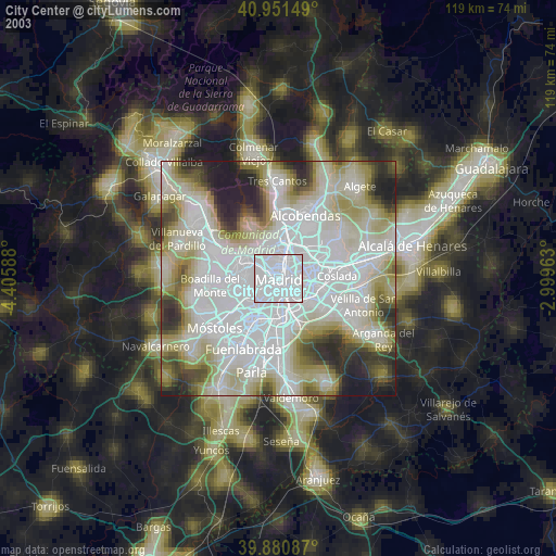
» NASA city lights 2003
» Earth at Night: Flat Maps 2012, 2016