Puente de Vallecas night lights from space
Night Light of Puente de Vallecas (Madrid) from space (Spain) Src. Average luminocity for 10x10km area is 96.9201% and for 50x50km: 56.489%.
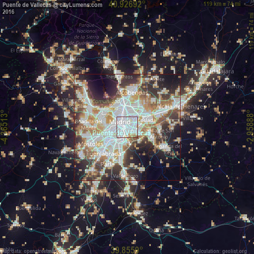
Analysis of Puente de Vallecas night lights 2016
Square area 10x10 km:
 67.35%
90-99
22.45%80-89
3.74%70-79
3.4%60-69
1.36%50-59
1.7%40-49
0%30-39
0%20-29
0%10-19
0%0-9
0%Square area 50x50 km:
16.32%90-99
14.46%80-89
5.05%70-79
6.59%60-69
6.22%50-59
6%40-49
5.91%30-39
7.54%20-29
10.51%10-19
10.41%0-9
10.99%Clear (daylight) street map image can be seen on geolist.org.
Map coordinates:
40° 55' 36.9" North, 4° 21' 54.5" West
40° 23' 36.7" North, 3° 39' 43.2" West
39° 51' 21.2" North, 2° 57' 32" West
Some cities around Puente de Vallecas sort by population:
• Madrid
4.3 km =2.7 mi,  306°
306°
• City Center
4.4 km =2.7 mi, 308°
• Arganzuela
3 km =1.9 mi,  284°
284°
• Salamanca
4.3 km =2.7 mi,  339°
339°
• Usera
3.3 km =2.1 mi,  260°
260°
• Retiro
2.8 km =1.7 mi,  320°
320°
• Moratalaz
1.9 km =1.2 mi,  34°
34°
• Vicálvaro
5.3 km =3.3 mi,  82°
82°
3112737 (p: 244,151)
Sources (retrieved 2019-11-25):
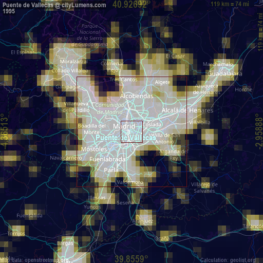
» NASA, Earths city lights 1995
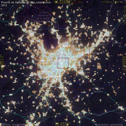
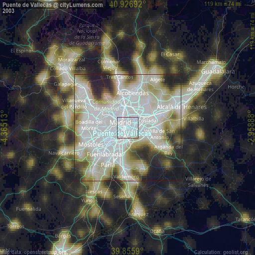
» NASA city lights 2003
» Earth at Night: Flat Maps 2012, 2016