Sant Cristòfol de les Fonts night lights from space
Night Light of Sant Cristòfol de les Fonts (Catalonia) from space (Spain) Src. Average luminocity for 10x10km area is 19.7227% and for 50x50km: 6.2693%.
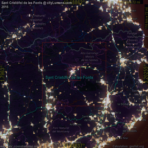
Analysis of Sant Cristòfol de les Fonts night lights 2016
Square area 10x10 km:
 1.82%
1.82%90-99
4.55%80-89
1.52%70-79
2.12%60-69
2.73%50-59
2.42%40-49
3.64%30-39
2.42%20-29
0.91%10-19
17.42%0-9
60.45%Square area 50x50 km:
0.67%90-99
0.97%80-89
0.6%70-79
0.6%60-69
0.81%50-59
1.01%40-49
0.73%30-39
0.78%20-29
1.67%10-19
5.39%0-9
86.76%Clear (daylight) street map image can be seen on geolist.org.
Map coordinates:
42° 41' 19" North, 1° 47' 46.7" East
42° 10' 10.7" North, 2° 29' 57.9" East
41° 38' 46.9" North, 3° 12' 9.2" East
Some cities around Sant Cristòfol de les Fonts sort by population:
• Olot
1.5 km =0.9 mi,  328°
328°
• Salt
32.5 km =20.2 mi,  131°
131°
• Manlleu
25.7 km =16 mi,  223°
223°
• Banyoles
22.8 km =14.2 mi,  104°
104°
• Vilaseca
23.4 km =14.5 mi,  239°
239°
• Torelló
23.6 km =14.7 mi,  234°
234°
• Ripoll
25.7 km =16 mi,  277°
277°
• Anglès
26.3 km =16.3 mi,  154°
154°
6533820 (p: 8,791)
Sources (retrieved 2019-11-25):
» Earth at Night: Flat Maps 2012, 2016