Moratalaz night lights from space
Night Light of Moratalaz (Madrid) from space (Spain) Src. Average luminocity for 10x10km area is 98.9558% and for 50x50km: 56.7208%.
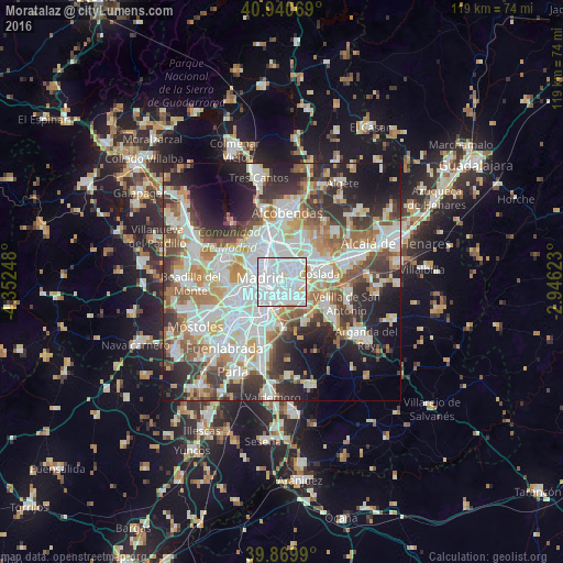
Analysis of Moratalaz night lights 2016
Square area 10x10 km:
 75%
75%90-99
21.26%80-89
3.06%70-79
0.68%60-69
0%50-59
0%40-49
0%30-39
0%20-29
0%10-19
0%0-9
0%Square area 50x50 km:
16.55%90-99
14.62%80-89
5.11%70-79
6.65%60-69
6.11%50-59
6%40-49
5.79%30-39
7.13%20-29
10.12%10-19
10.79%0-9
11.12%Clear (daylight) street map image can be seen on geolist.org.
Map coordinates:
40° 56' 26.5" North, 4° 21' 8.9" West
40° 24' 26.7" North, 3° 38' 57.7" West
39° 52' 11.6" North, 2° 56' 46.4" West
Some cities around Moratalaz sort by population:
• Madrid
4.6 km =2.9 mi,  282°
282°
• Puente de Vallecas
1.9 km =1.2 mi,  214°
214°
• Ciudad Lineal
4.2 km =2.6 mi,  357°
357°
• San Blas-Canillejas
4.5 km =2.8 mi,  39°
39°
• Arganzuela
4 km =2.5 mi,  258°
258°
• Salamanca
3.6 km =2.2 mi,  313°
313°
• Retiro
2.9 km =1.8 mi, 282°
• Vicálvaro
4.3 km =2.7 mi,  101°
101°
3116156 (p: 104,923)
Sources (retrieved 2019-11-25):
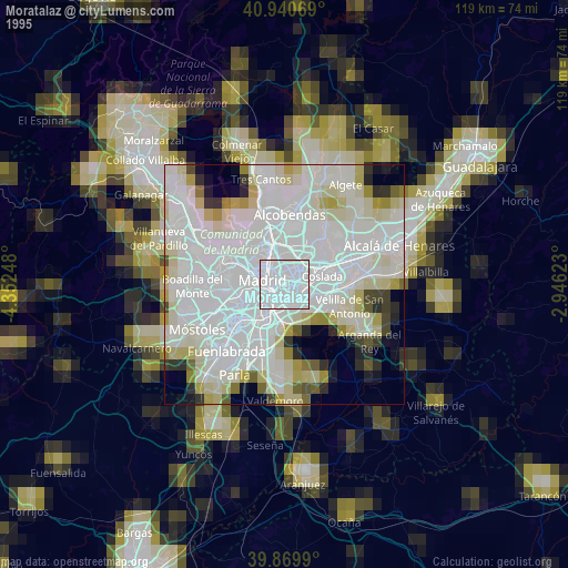
» NASA, Earths city lights 1995
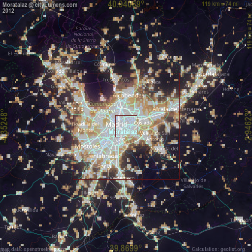
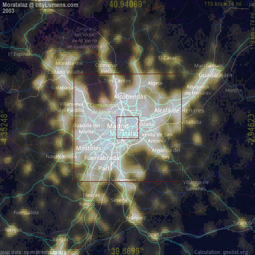
» NASA city lights 2003
» Earth at Night: Flat Maps 2012, 2016