Oroso night lights from space
Night Light of Oroso (Galicia) from space (Spain) Src. Average luminocity for 10x10km area is 9.2937% and for 50x50km: 8.6493%.
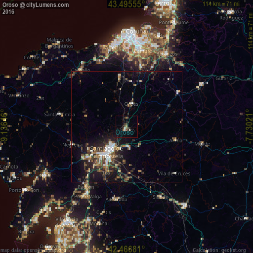
Analysis of Oroso night lights 2016
Square area 10x10 km:
 0.79%
0.79%90-99
1.11%80-89
0%70-79
0.63%60-69
1.9%50-59
0.16%40-49
2.38%30-39
2.54%20-29
2.7%10-19
3.02%0-9
84.76%Square area 50x50 km:
0.87%90-99
1.31%80-89
0.53%70-79
0.76%60-69
1.14%50-59
1.29%40-49
1.67%30-39
2.18%20-29
3.25%10-19
6%0-9
81.01%Clear (daylight) street map image can be seen on geolist.org.
Map coordinates:
43° 29' 44" North, 9° 8' 11.3" West
42° 58' 60" North, 8° 25' 60" West
42° 28' 0.5" North, 7° 43' 48.8" West
Some cities around Oroso sort by population:
• Santiago de Compostela
14.6 km =9.1 mi,  218°
218°
• Ribeira
26.4 km =16.4 mi,  181°
181°
• Amés
20.1 km =12.5 mi,  244°
244°
• Teo
26.5 km =16.5 mi,  191°
191°
• Ordes
10.6 km =6.6 mi,  10°
10°
• Negreira
26.7 km =16.6 mi,  250°
250°
• Arzúa
23.7 km =14.7 mi,  103°
103°
• Vedra
23.1 km =14.4 mi, 188°
3114904 (p: 6,378)
Sources (retrieved 2019-11-25):
» Earth at Night: Flat Maps 2012, 2016