La Solana night lights from space
Night Light of La Solana (Castille-La Mancha) from space (Spain) Src. Average luminocity for 10x10km area is 9.1558% and for 50x50km: 3.5109%.
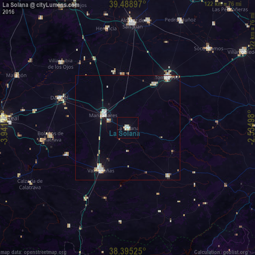
Analysis of La Solana night lights 2016
Square area 10x10 km:
 1.3%
1.3%90-99
2.6%80-89
1.95%70-79
0%60-69
1.3%50-59
0.65%40-49
0%30-39
0%20-29
0.65%10-19
0%0-9
91.56%Square area 50x50 km:
0.52%90-99
0.88%80-89
0.45%70-79
0.37%60-69
0.33%50-59
0.2%40-49
0.13%30-39
0.21%20-29
0.32%10-19
1.85%0-9
94.74%Clear (daylight) street map image can be seen on geolist.org.
Map coordinates:
39° 29' 20.3" North, 3° 56' 28.4" West
38° 56' 39.2" North, 3° 14' 17.2" West
38° 23' 42.9" North, 2° 32' 5.9" West
Some cities around La Solana sort by population:
• Tomelloso
30.2 km =18.8 mi,  38°
38°
• Valdepeñas
23.9 km =14.9 mi,  212°
212°
• Manzanares
12.9 km =8 mi,  298°
298°
• Daimiel
35.4 km =22 mi,  293°
293°
• Argamasilla de Alba
24.1 km =15 mi,  31°
31°
• Membrilla
9.6 km =6 mi, 288°
• Infantes
30.3 km =18.8 mi,  139°
139°
• Moral de Calatrava
32.1 km =19.9 mi,  246°
246°
2515284 (p: 16,511)
Sources (retrieved 2019-11-25):
» Earth at Night: Flat Maps 2012, 2016