Hortaleza night lights from space
Night Light of Hortaleza (Madrid) from space (Spain) Src. Average luminocity for 10x10km area is 96.3316% and for 50x50km: 54.6428%.
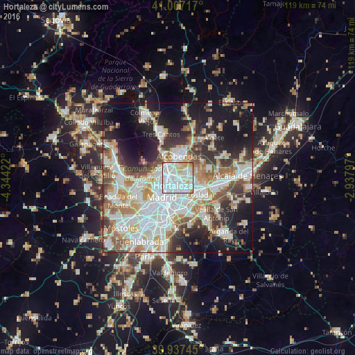
Analysis of Hortaleza night lights 2016
Square area 10x10 km:
 62.41%
90-99
23.13%80-89
7.82%70-79
5.1%60-69
1.19%50-59
0.34%40-49
0%30-39
0%20-29
0%10-19
0%0-9
0%Square area 50x50 km:
16.15%90-99
14.08%80-89
4.72%70-79
6.27%60-69
5.89%50-59
5.63%40-49
5.36%30-39
5.53%20-29
8.88%10-19
16.62%0-9
10.87%Clear (daylight) street map image can be seen on geolist.org.
Map coordinates:
41° 0' 25.8" North, 4° 20' 39.2" West
40° 28' 28" North, 3° 38' 28" West
39° 56' 14.8" North, 2° 56' 16.7" West
Some cities around Hortaleza sort by population:
• Ciudad Lineal
3.4 km =2.1 mi,  194°
194°
• San Blas-Canillejas
4.5 km =2.8 mi,  151°
151°
• Tetuán de las Victorias
5 km =3.1 mi,  251°
251°
• Salamanca
6 km =3.7 mi,  213°
213°
• Chamberí
7 km =4.3 mi,  229°
229°
• Chamartín
3.3 km =2.1 mi, 245°
• Barajas de Madrid
5.4 km =3.4 mi,  90°
90°
• Pinar de Chamartín
2.4 km =1.5 mi,  282°
282°
3120635 (p: 161,661)
Sources (retrieved 2019-11-25):
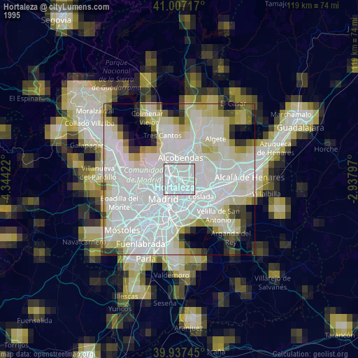
» NASA, Earths city lights 1995
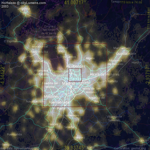
» NASA city lights 2003
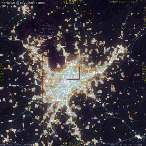
» Earth at Night: Flat Maps 2012, 2016