Chamberí night lights from space
Night Light of Chamberí (Madrid) from space (Spain) Src. Average luminocity for 10x10km area is 96.6224% and for 50x50km: 56.9019%.
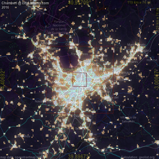
Analysis of Chamberí night lights 2016
Square area 10x10 km:
 65.14%
90-99
23.3%80-89
1.7%70-79
8.67%60-69
1.19%50-59
0%40-49
0%30-39
0%20-29
0%10-19
0%0-9
0%Square area 50x50 km:
16.04%90-99
14.41%80-89
5.19%70-79
6.73%60-69
6.52%50-59
5.93%40-49
5.66%30-39
7.35%20-29
11.7%10-19
12.77%0-9
7.69%Clear (daylight) street map image can be seen on geolist.org.
Map coordinates:
40° 58' 1.5" North, 4° 24' 24.9" West
40° 26' 2.5" North, 3° 42' 13.6" West
39° 53' 48.2" North, 3° 0' 2.4" West
Some cities around Chamberí sort by population:
• Madrid
2 km =1.2 mi,  176°
176°
• Tetuán de las Victorias
2.9 km =1.8 mi,  10°
10°
• City Center
1.8 km =1.1 mi, 177°
• Arganzuela
3.8 km =2.4 mi,  170°
170°
• Salamanca
2.1 km =1.3 mi,  103°
103°
• Chamartín
3.9 km =2.4 mi,  36°
36°
• Retiro
2.9 km =1.8 mi,  142°
142°
• Moncloa-Aravaca
2.4 km =1.5 mi,  273°
273°
6544492 (p: 145,934)
Sources (retrieved 2019-11-25):
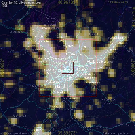
» NASA, Earths city lights 1995
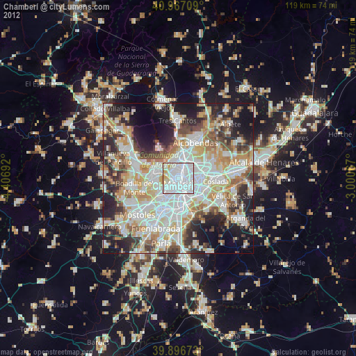
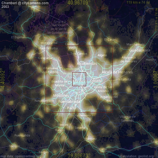
» NASA city lights 2003
» Earth at Night: Flat Maps 2012, 2016