Barajas de Madrid night lights from space
Night Light of Barajas de Madrid (Madrid) from space (Spain) Src. Average luminocity for 10x10km area is 86.1361% and for 50x50km: 50.9825%.
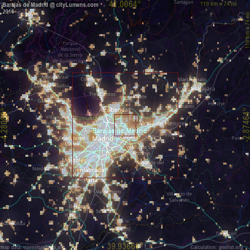
Analysis of Barajas de Madrid night lights 2016
Square area 10x10 km:
 29.76%
90-99
25.68%80-89
9.52%70-79
15.31%60-69
12.59%50-59
5.95%40-49
1.19%30-39
0%20-29
0%10-19
0%0-9
0%Square area 50x50 km:
15.03%90-99
12.71%80-89
4.59%70-79
5.86%60-69
5.26%50-59
4.67%40-49
4.74%30-39
5.27%20-29
9.59%10-19
17.88%0-9
14.4%Clear (daylight) street map image can be seen on geolist.org.
Map coordinates:
41° 0' 23" North, 4° 16' 51.2" West
40° 28' 25.2" North, 3° 34' 40" West
39° 56' 12" North, 2° 52' 28.7" West
Some cities around Barajas de Madrid sort by population:
• Ciudad Lineal
7 km =4.3 mi,  242°
242°
• Hortaleza
5.4 km =3.4 mi,  270°
270°
• San Blas-Canillejas
5 km =3.1 mi,  219°
219°
• Coslada
5.7 km =3.5 mi,  165°
165°
• Vicálvaro
8.4 km =5.2 mi,  192°
192°
• San Fernando de Henares
6.7 km =4.2 mi,  145°
145°
• Pinar de Chamartín
7.7 km =4.8 mi, 274°
• Paracuellos de Jarama
5.4 km =3.4 mi,  51°
51°
3128832 (p: 43,423)
Sources (retrieved 2019-11-25):
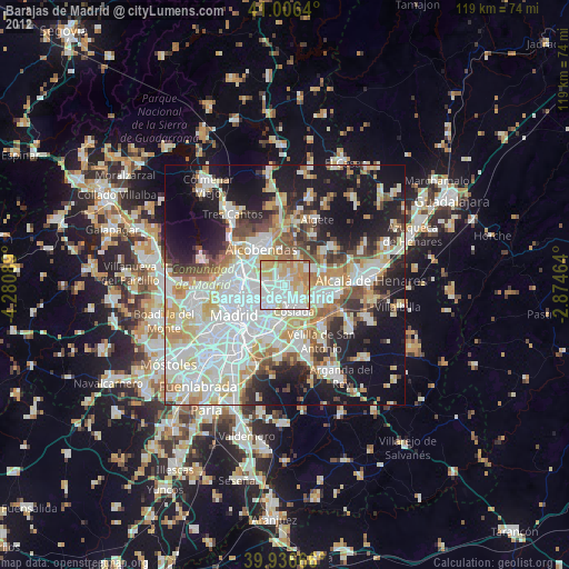
» Earth at Night: Flat Maps 2012, 2016