Casariche night lights from space
Night Light of Casariche (Andalusia) from space (Spain) Src. Average luminocity for 10x10km area is 9.8653% and for 50x50km: 6.7169%.
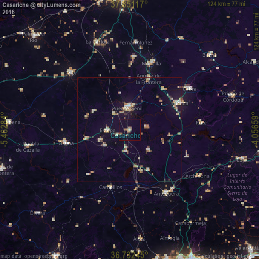
Analysis of Casariche night lights 2016
Square area 10x10 km:
 0.32%
0.32%90-99
0.32%80-89
0%70-79
1.3%60-69
4.22%50-59
1.3%40-49
0.65%30-39
0.81%20-29
1.14%10-19
0.65%0-9
89.29%Square area 50x50 km:
0.44%90-99
0.74%80-89
1.34%70-79
0.76%60-69
1.24%50-59
0.57%40-49
0.71%30-39
0.99%20-29
0.59%10-19
2.95%0-9
89.69%Clear (daylight) street map image can be seen on geolist.org.
Map coordinates:
37° 51' 4.2" North, 5° 27' 46.2" West
37° 17' 38" North, 4° 45' 35" West
36° 43' 56.8" North, 4° 3' 23.7" West
Some cities around Casariche sort by population:
• Lucena
27.4 km =17 mi,  62°
62°
• Puente-Genil
10.6 km =6.6 mi,  356°
356°
• Aguilar
26.2 km =16.3 mi,  20°
20°
• Estepa
10.5 km =6.5 mi,  269°
269°
• Campillos
28.8 km =17.9 mi,  198°
198°
• Herrera
11.1 km =6.9 mi,  314°
314°
• Alameda
13 km =8.1 mi,  136°
136°
• Pedrera
14.1 km =8.8 mi,  237°
237°
2519979 (p: 5,389)
Sources (retrieved 2019-11-25):
» Earth at Night: Flat Maps 2012, 2016