Gandia night lights from space
Night Light of Gandia (Valencia) from space (Spain) Src. Average luminocity for 10x10km area is 49.0211% and for 50x50km: 12.5526%.
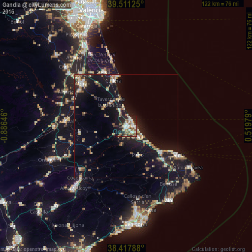

Analysis of Gandia night lights 2016
Square area 10x10 km:
 9.09%
9.09%90-99
11.69%80-89
6.01%70-79
2.92%60-69
6.66%50-59
9.09%40-49
3.57%30-39
6.98%20-29
21.27%10-19
21.59%0-9
1.14%Square area 50x50 km:
1.28%90-99
1.78%80-89
1.75%70-79
1.45%60-69
1.34%50-59
1.68%40-49
1.14%30-39
2.01%20-29
3.4%10-19
14.11%0-9
70.06%Clear (daylight) street map image can be seen on geolist.org.
Map coordinates:
39° 30' 40.5" North, 0° 53' 11.3" West
38° 58' 0" North, 0° 10' 60" West
38° 25' 4.4" North, 0° 31' 11.2" East
Some cities around Gandia sort by population:
• Sueca
28.5 km =17.7 mi,  337°
337°
• Oliva
7.6 km =4.7 mi,  133°
133°
• Cullera
23 km =14.3 mi,  345°
345°
• Tavernes de la Valldigna
13.7 km =8.5 mi,  328°
328°
• Pego
14.9 km =9.3 mi,  157°
157°
• Pedreguer
27 km =16.8 mi,  135°
135°
• Ondara
23.2 km =14.4 mi, 131°
• Benigànim
21.7 km =13.5 mi,  265°
265°
2517367 (p: 80,020)
Sources (retrieved 2019-11-25):
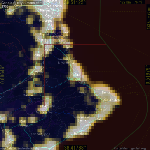
» NASA, Earths city lights 1995
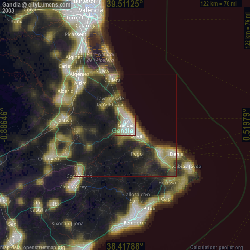
» NASA city lights 2003
» Earth at Night: Flat Maps 2012, 2016