Benigànim night lights from space
Night Light of Benigànim (Valencia) from space (Spain) Src. Average luminocity for 10x10km area is 8.7256% and for 50x50km: 13.5229%.
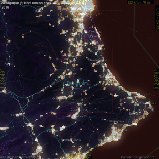
Analysis of Benigànim night lights 2016
Square area 10x10 km:
 0.65%
0.65%90-99
0.97%80-89
1.3%70-79
1.3%60-69
0%50-59
0.65%40-49
1.3%30-39
0.97%20-29
1.95%10-19
1.3%0-9
89.61%Square area 50x50 km:
1.09%90-99
1.67%80-89
1.89%70-79
1.76%60-69
1.64%50-59
1.83%40-49
1.12%30-39
2.04%20-29
3.04%10-19
15.62%0-9
68.3%Clear (daylight) street map image can be seen on geolist.org.
Map coordinates:
39° 29' 40.9" North, 1° 8' 11.3" West
38° 57' 0" North, 0° 25' 60" West
38° 24' 3.9" North, 0° 16' 11.2" East
Some cities around Benigànim sort by population:
• Xàtiva
8.6 km =5.3 mi,  301°
301°
• Carcaixent
19.1 km =11.9 mi,  356°
356°
• Tavernes de la Valldigna
19.8 km =12.3 mi,  46°
46°
• Canals
13.1 km =8.1 mi,  276°
276°
• Muro del Alcoy
18.8 km =11.7 mi,  180°
180°
• L'Olleria
10.7 km =6.6 mi,  249°
249°
• Villanueva de Castellón
15.7 km =9.8 mi,  334°
334°
• Albaida
14.4 km =8.9 mi,  210°
210°
2521075 (p: 5,720)
Sources (retrieved 2019-11-25):
» Earth at Night: Flat Maps 2012, 2016