Pego night lights from space
Night Light of Pego (Valencia) from space (Spain) Src. Average luminocity for 10x10km area is 10.8095% and for 50x50km: 12.1325%.
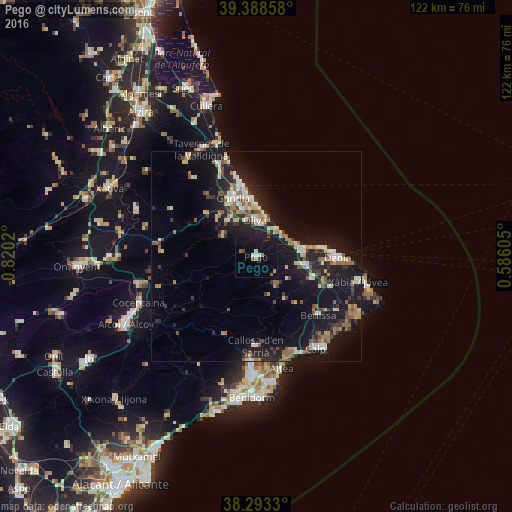
Analysis of Pego night lights 2016
Square area 10x10 km:
 0.51%
0.51%90-99
1.02%80-89
1.19%70-79
0.68%60-69
1.36%50-59
1.53%40-49
1.53%30-39
0.68%20-29
0%10-19
17.35%0-9
74.15%Square area 50x50 km:
1.12%90-99
1.55%80-89
1.6%70-79
1.16%60-69
1.39%50-59
2.05%40-49
1.44%30-39
1.86%20-29
3.43%10-19
15.32%0-9
69.08%Clear (daylight) street map image can be seen on geolist.org.
Map coordinates:
39° 23' 18.9" North, 0° 49' 12.7" West
38° 50' 35" North, 0° 7' 1.5" West
38° 17' 35.9" North, 0° 35' 9.8" East
Some cities around Pego sort by population:
• Gandia
14.9 km =9.3 mi,  337°
337°
• Denia
19.3 km =12 mi,  90°
90°
• Oliva
8.5 km =5.3 mi,  358°
358°
• Teulada
22.9 km =14.2 mi,  123°
123°
• Benissa
20.2 km =12.6 mi,  134°
134°
• Pedreguer
14.2 km =8.8 mi,  112°
112°
• Ondara
11.7 km =7.3 mi,  98°
98°
• Gata de Gorgos
19.1 km =11.9 mi, 113°
6559502 (p: 11,133)
Sources (retrieved 2019-11-25):
» Earth at Night: Flat Maps 2012, 2016