Eixample night lights from space
Night Light of Eixample (Catalonia) from space (Spain) Src. Average luminocity for 10x10km area is 90.2891% and for 50x50km: 41.4356%.
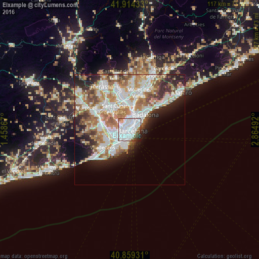
Analysis of Eixample night lights 2016
Square area 10x10 km:
 58.5%
58.5%90-99
22.79%80-89
1.02%70-79
2.72%60-69
1.02%50-59
5.27%40-49
3.57%30-39
2.04%20-29
2.72%10-19
0.34%0-9
0%Square area 50x50 km:
11.47%90-99
10.18%80-89
3.84%70-79
4.91%60-69
7.2%50-59
5.41%40-49
3.33%30-39
3.62%20-29
6.7%10-19
6.06%0-9
37.31%Clear (daylight) street map image can be seen on geolist.org.
Map coordinates:
41° 54' 51.6" North, 1° 27' 31.2" East
41° 23' 20.3" North, 2° 9' 42.4" East
40° 51' 33.5" North, 2° 51' 53.7" East
Some cities around Eixample sort by population:
• Barcelona
0.2 km =0.1 mi,  265°
265°
• Ciutat Vella
1.4 km =0.9 mi,  135°
135°
• la Nova Esquerra de l'Eixample
1.3 km =0.8 mi,  238°
238°
• el Raval
1.1 km =0.7 mi,  149°
149°
• Dreta de l'Eixample
0.9 km =0.6 mi,  28°
28°
• l'Antiga Esquerra de l'Eixample
0.6 km =0.4 mi, 274°
• Sant Antoni
1.2 km =0.7 mi,  189°
189°
• Barri Gòtic
1.3 km =0.8 mi,  116°
116°
6544100 (p: 266,477)
Sources (retrieved 2019-11-25):
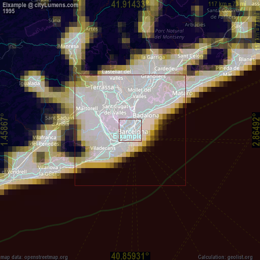
» NASA, Earths city lights 1995
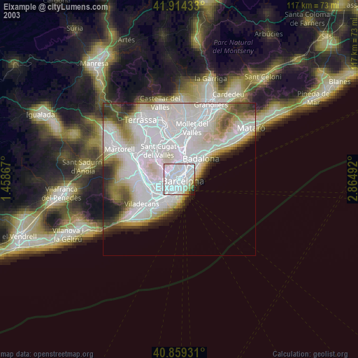
» NASA city lights 2003
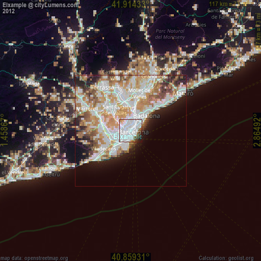
» Earth at Night: Flat Maps 2012, 2016