Barcelona night lights from space
Night Light of Barcelona (Catalonia) from space (Spain) Src. Average luminocity for 10x10km area is 91.4456% and for 50x50km: 41.5552%.
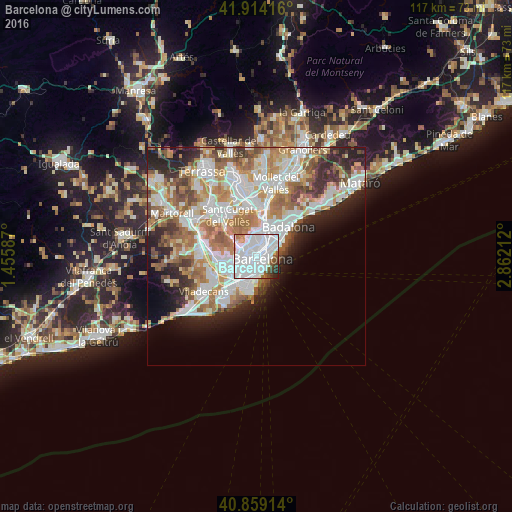

Analysis of Barcelona night lights 2016
Square area 10x10 km:
 58.84%
90-99
23.64%80-89
1.36%70-79
3.23%60-69
1.19%50-59
4.76%40-49
3.23%30-39
1.53%20-29
2.04%10-19
0.17%0-9
0%Square area 50x50 km:
11.49%90-99
10.16%80-89
3.87%70-79
4.92%60-69
7.21%50-59
5.46%40-49
3.34%30-39
3.65%20-29
6.7%10-19
6.17%0-9
37.03%Clear (daylight) street map image can be seen on geolist.org.
Map coordinates:
41° 54' 51" North, 1° 27' 21.1" East
41° 23' 19.6" North, 2° 9' 32.4" East
40° 51' 32.9" North, 2° 51' 43.6" East
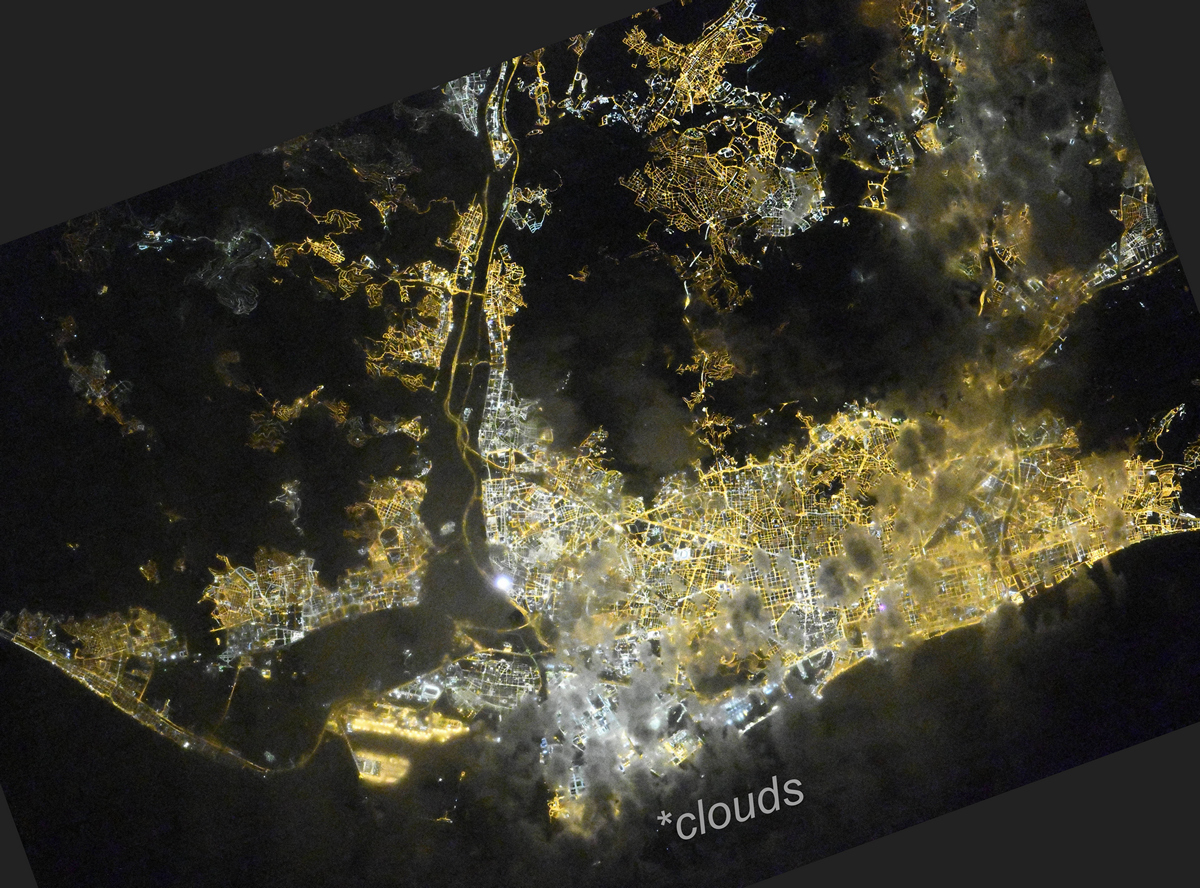
Fantastic image of Barcelona from space taken by astronauts [src2], but I don't have information about it's orientation, scale or angle. If necessary, it was rotated manually, so North points approximately to upper direction. Click to zoom in:
Some cities around Barcelona sort by population:
• Eixample
0.2 km =0.1 mi,  85°
85°
• GrĂ cia
1.5 km =0.9 mi,  351°
351°
• Ciutat Vella
1.5 km =0.9 mi,  128°
128°
• la Nova Esquerra de l'Eixample
1 km =0.6 mi,  232°
232°
• el Raval
1.2 km =0.7 mi,  139°
139°
• Dreta de l'Eixample
1 km =0.6 mi,  39°
39°
• l'Antiga Esquerra de l'Eixample
0.3 km =0.2 mi,  281°
281°
• Sant Antoni
1.1 km =0.7 mi,  178°
178°
3128760 (p: 1,621,537)
Sources (retrieved 2019-11-25):
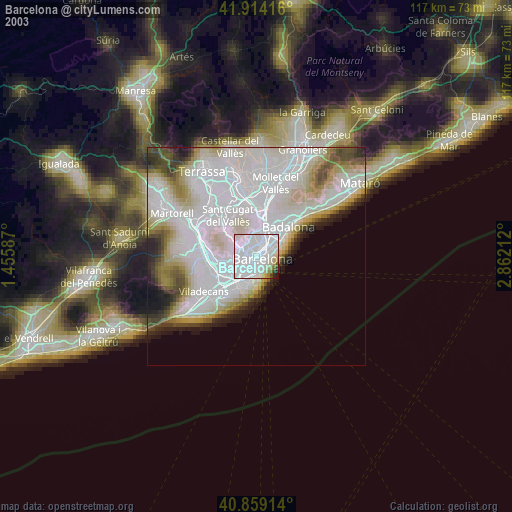
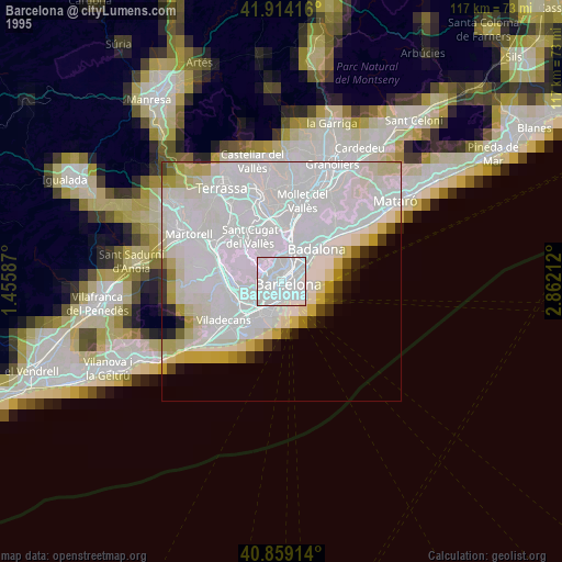
» NASA, Earths city lights 1995
» NASA city lights 2003
» Earth at Night: Flat Maps 2012, 2016
Src.2: picture by Oleg Kononenko, Roscosmos, retrieved 2019-11-29