Collado-Villalba night lights from space
Night Light of Collado-Villalba (Madrid) from space (Spain) Src. Average luminocity for 10x10km area is 57.2841% and for 50x50km: 24.5852%.
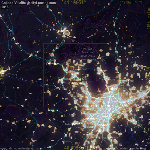
Analysis of Collado-Villalba night lights 2016
Square area 10x10 km:
 7.14%
7.14%90-99
11.69%80-89
6.98%70-79
9.9%60-69
10.55%50-59
6.98%40-49
9.42%30-39
15.1%20-29
22.24%10-19
0%0-9
0%Square area 50x50 km:
3.55%90-99
5.06%80-89
2.33%70-79
3.77%60-69
3.37%50-59
2.43%40-49
3.11%30-39
3.94%20-29
7.39%10-19
13.6%0-9
51.45%Clear (daylight) street map image can be seen on geolist.org.
Map coordinates:
41° 9' 59.4" North, 4° 42' 28.8" West
40° 38' 6.2" North, 4° 0' 17.5" West
40° 5' 57.7" North, 3° 18' 6.3" West
Some cities around Collado-Villalba sort by population:
• Galapagar
6.3 km =3.9 mi,  179°
179°
• Torrelodones
9.3 km =5.8 mi,  134°
134°
• Guadarrama
8.3 km =5.2 mi,  300°
300°
• Alpedrete
3.2 km =2 mi,  327°
327°
• Moralzarzal
5.6 km =3.5 mi,  31°
31°
• Colmenarejo
8.3 km =5.2 mi,  187°
187°
• Hoyo de Manzanares
8.3 km =5.2 mi,  99°
99°
• Boalo
11.7 km =7.3 mi,  39°
39°
3124794 (p: 55,027)
Sources (retrieved 2019-11-25):
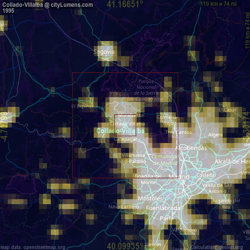
» NASA, Earths city lights 1995
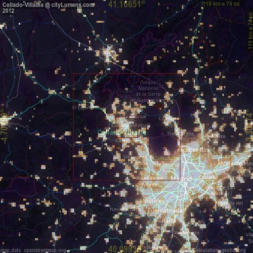
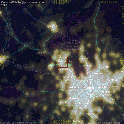
» NASA city lights 2003
» Earth at Night: Flat Maps 2012, 2016