Carlet night lights from space
Night Light of Carlet (Valencia) from space (Spain) Src. Average luminocity for 10x10km area is 33.1854% and for 50x50km: 19.8473%.
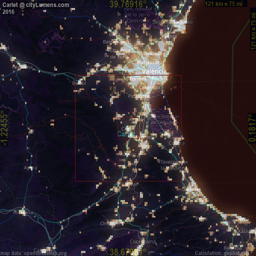
Analysis of Carlet night lights 2016
Square area 10x10 km:
 4.42%
4.42%90-99
4.93%80-89
4.25%70-79
4.59%60-69
3.74%50-59
4.08%40-49
2.38%30-39
4.76%20-29
17.86%10-19
32.14%0-9
16.84%Square area 50x50 km:
2.64%90-99
3.16%80-89
2.3%70-79
2.26%60-69
2.55%50-59
2.77%40-49
1.97%30-39
3.25%20-29
6.53%10-19
17.53%0-9
55.05%Clear (daylight) street map image can be seen on geolist.org.
Map coordinates:
39° 46' 9" North, 1° 13' 28.4" West
39° 13' 35.8" North, 0° 31' 17.1" West
38° 40' 47.3" North, 0° 10' 54.1" East
Some cities around Carlet sort by population:
• Alzira
11.4 km =7.1 mi,  138°
138°
• Algemesí
8.4 km =5.2 mi,  118°
118°
• Alginet
6.5 km =4 mi,  46°
46°
• Benifaió
10.4 km =6.5 mi, 51°
• L'Alcúdia
3.6 km =2.2 mi,  157°
157°
• Alberic
12.2 km =7.6 mi,  178°
178°
• Almussafes
11 km =6.8 mi,  55°
55°
• Guadassuar
5.8 km =3.6 mi, 140°
2520121 (p: 15,527)
Sources (retrieved 2019-11-25):
» Earth at Night: Flat Maps 2012, 2016