Benifaió night lights from space
Night Light of Benifaió (Valencia) from space (Spain) Src. Average luminocity for 10x10km area is 42.6395% and for 50x50km: 24.5218%.
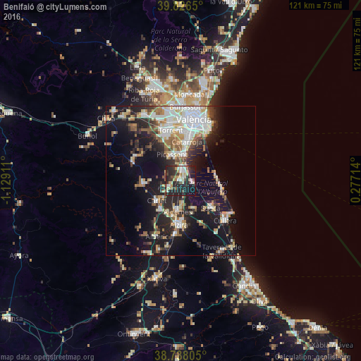
Analysis of Benifaió night lights 2016
Square area 10x10 km:
 4.76%
4.76%90-99
7.82%80-89
6.63%70-79
6.29%60-69
3.06%50-59
3.06%40-49
4.76%30-39
12.59%20-29
29.25%10-19
20.75%0-9
1.02%Square area 50x50 km:
4.88%90-99
4.79%80-89
2.59%70-79
2.65%60-69
2.8%50-59
2.77%40-49
2.17%30-39
3.56%20-29
7.26%10-19
17.24%0-9
49.28%Clear (daylight) street map image can be seen on geolist.org.
Map coordinates:
39° 49' 35.4" North, 1° 7' 44.8" West
39° 17' 3.8" North, 0° 25' 33.5" West
38° 44' 17" North, 0° 16' 37.7" East
Some cities around Benifaió sort by population:
• Algemesí
10.5 km =6.5 mi,  184°
184°
• Picassent
9.3 km =5.8 mi,  341°
341°
• Silla
8.8 km =5.5 mi,  8°
8°
• Carlet
10.4 km =6.5 mi,  231°
231°
• Alginet
4 km =2.5 mi,  240°
240°
• Alcàsser
9.4 km =5.8 mi,  350°
350°
• Almussafes
0.8 km =0.5 mi,  98°
98°
• Guadassuar
11.8 km =7.3 mi,  202°
202°
2521080 (p: 12,204)
Sources (retrieved 2019-11-25):
» Earth at Night: Flat Maps 2012, 2016