Alberic night lights from space
Night Light of Alberic (Valencia) from space (Spain) Src. Average luminocity for 10x10km area is 28.4854% and for 50x50km: 14.3813%.
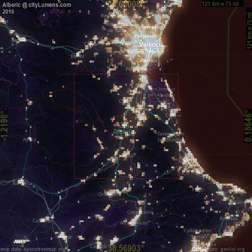
Analysis of Alberic night lights 2016
Square area 10x10 km:
 1.46%
1.46%90-99
2.27%80-89
2.44%70-79
4.55%60-69
3.41%50-59
4.55%40-49
3.9%30-39
6.33%20-29
13.31%10-19
49.51%0-9
8.28%Square area 50x50 km:
1.1%90-99
1.67%80-89
2.05%70-79
2.14%60-69
1.65%50-59
1.73%40-49
1.27%30-39
2.44%20-29
4.72%10-19
16.3%0-9
64.93%Clear (daylight) street map image can be seen on geolist.org.
Map coordinates:
39° 39' 36.3" North, 1° 13' 11.3" West
39° 7' 0" North, 0° 31' 0" West
38° 34' 8.5" North, 0° 11' 11.3" East
Some cities around Alberic sort by population:
• Alzira
8.1 km =5 mi,  62°
62°
• Xàtiva
14 km =8.7 mi,  180°
180°
• Algemesí
10.8 km =6.7 mi,  40°
40°
• Carcaixent
5.9 km =3.7 mi,  84°
84°
• Carlet
12.2 km =7.6 mi,  358°
358°
• L'Alcúdia
9 km =5.6 mi,  6°
6°
• Villanueva de Castellón
4.4 km =2.7 mi,  174°
174°
• Guadassuar
8.4 km =5.2 mi,  22°
22°
2522222 (p: 11,175)
Sources (retrieved 2019-11-25):
» Earth at Night: Flat Maps 2012, 2016