Algemesí night lights from space
Night Light of Algemesí (Valencia) from space (Spain) Src. Average luminocity for 10x10km area is 43.9951% and for 50x50km: 18.3673%.
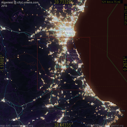
Analysis of Algemesí night lights 2016
Square area 10x10 km:
 4.87%
4.87%90-99
7.95%80-89
7.14%70-79
7.63%60-69
3.57%50-59
4.71%40-49
2.6%30-39
7.95%20-29
37.01%10-19
16.56%0-9
0%Square area 50x50 km:
1.88%90-99
2.41%80-89
2.19%70-79
2.37%60-69
2.49%50-59
2.5%40-49
1.9%30-39
3.13%20-29
6.59%10-19
18.63%0-9
55.9%Clear (daylight) street map image can be seen on geolist.org.
Map coordinates:
39° 43' 59.7" North, 1° 8' 19.9" West
39° 11' 25.5" North, 0° 26' 8.6" West
38° 38' 36.1" North, 0° 16' 2.6" East
Some cities around Algemesí sort by population:
• Alzira
4.5 km =2.8 mi,  177°
177°
• Carcaixent
7.7 km =4.8 mi,  187°
187°
• Carlet
8.4 km =5.2 mi,  298°
298°
• Alginet
8.9 km =5.5 mi,  342°
342°
• Benifaió
10.5 km =6.5 mi,  4°
4°
• L'Alcúdia
6 km =3.7 mi,  277°
277°
• Almussafes
10.5 km =6.5 mi,  9°
9°
• Guadassuar
3.7 km =2.3 mi,  263°
263°
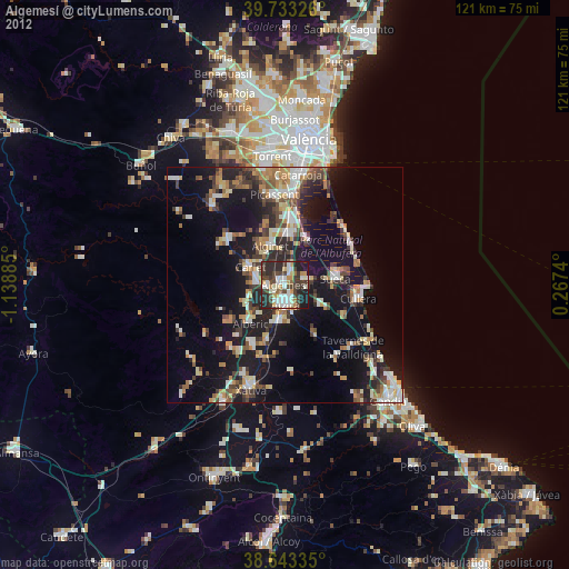
2522012 (p: 28,308)
Sources (retrieved 2019-11-25):
» Earth at Night: Flat Maps 2012, 2016