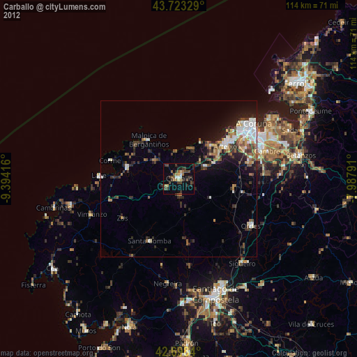
Carballo night lights from space
Night Light of Carballo (Galicia) from space (Spain) Src. Average luminocity for 10x10km area is 10.9712% and for 50x50km: 8.9802%.
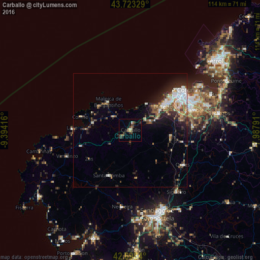
Analysis of Carballo night lights 2016
Square area 10x10 km:
 0.45%
0.45%90-99
0.45%80-89
1.36%70-79
0.15%60-69
2.42%50-59
1.52%40-49
2.58%30-39
4.7%20-29
3.33%10-19
2.12%0-9
80.91%Square area 50x50 km:
1.46%90-99
1.66%80-89
0.78%70-79
0.8%60-69
1.2%50-59
0.98%40-49
1.37%30-39
1.3%20-29
3.23%10-19
4.02%0-9
83.2%Clear (daylight) street map image can be seen on geolist.org.
Map coordinates:
43° 43' 23.8" North, 9° 23' 39" West
43° 12' 46.8" North, 8° 41' 27.7" West
42° 41' 54.2" North, 7° 59' 16.5" West
Some cities around Carballo sort by population:
• Arteixo
18 km =11.2 mi,  55°
55°
• Culleredo
25.9 km =16.1 mi,  71°
71°
• Ordes
27.5 km =17.1 mi,  123°
123°
• Laracha
9.7 km =6 mi, 62°
• Santa Comba
22.2 km =13.8 mi,  205°
205°
• Coristanco
5 km =3.1 mi,  253°
253°
• Malpica
15.6 km =9.7 mi,  321°
321°
• Carral
27.2 km =16.9 mi,  86°
86°
3126369 (p: 30,990)
Sources (retrieved 2019-11-25):
» Earth at Night: Flat Maps 2012, 2016