Laracha night lights from space
Night Light of Laracha (Galicia) from space (Spain) Src. Average luminocity for 10x10km area is 21.9621% and for 50x50km: 13.3168%.
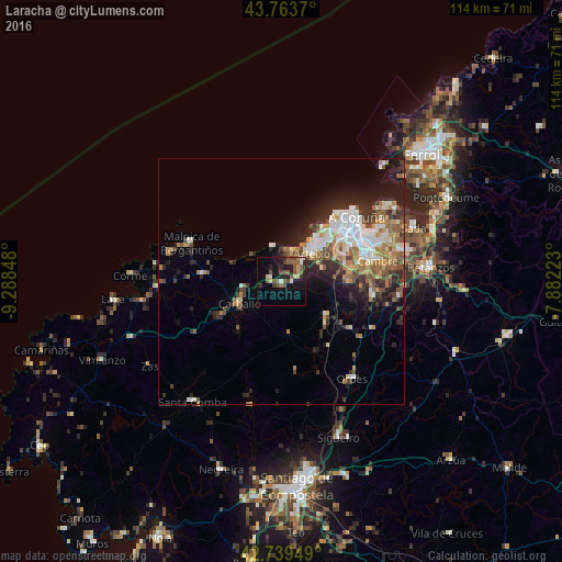
Analysis of Laracha night lights 2016
Square area 10x10 km:
 0.45%
0.45%90-99
3.79%80-89
1.82%70-79
1.21%60-69
3.18%50-59
6.67%40-49
5.76%30-39
2.58%20-29
5.76%10-19
18.79%0-9
50%Square area 50x50 km:
2.03%90-99
2.62%80-89
1.13%70-79
1.45%60-69
2.26%50-59
1.88%40-49
1.95%30-39
2.01%20-29
3.84%10-19
6.09%0-9
74.72%Clear (daylight) street map image can be seen on geolist.org.
Map coordinates:
43° 45' 49.3" North, 9° 17' 18.5" West
43° 15' 13.5" North, 8° 35' 7.3" West
42° 44' 22.2" North, 7° 52' 56" West
Some cities around Laracha sort by population:
• A Coruña
20.1 km =12.5 mi,  49°
49°
• Carballo
9.7 km =6 mi,  242°
242°
• Arteixo
8.5 km =5.3 mi, 47°
• Culleredo
16.4 km =10.2 mi,  76°
76°
• Cambre
19.8 km =12.3 mi, 76°
• Coristanco
14.6 km =9.1 mi,  245°
245°
• Malpica
19.8 km =12.3 mi,  292°
292°
• Carral
18.8 km =11.7 mi,  98°
98°
3119172 (p: 11,171)
Sources (retrieved 2019-11-25):
» Earth at Night: Flat Maps 2012, 2016