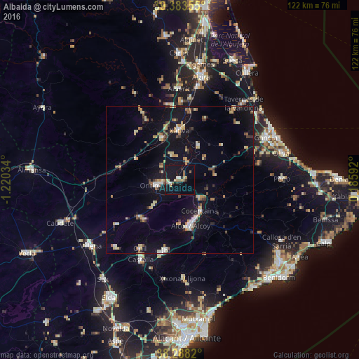
Albaida night lights from space
Night Light of Albaida (Valencia) from space (Spain) Src. Average luminocity for 10x10km area is 17.8844% and for 50x50km: 8.8711%.
Analysis of Albaida night lights 2016
Square area 10x10 km:
 1.7%
1.7%90-99
1.02%80-89
3.06%70-79
1.53%60-69
3.23%50-59
2.89%40-49
0.17%30-39
1.53%20-29
1.87%10-19
32.65%0-9
50.34%Square area 50x50 km:
0.62%90-99
1.04%80-89
1.43%70-79
1.16%60-69
1.08%50-59
0.98%40-49
0.62%30-39
1.14%20-29
1.07%10-19
8.81%0-9
82.04%Clear (daylight) street map image can be seen on geolist.org.
Map coordinates:
39° 23' 0.8" North, 1° 13' 13.2" West
38° 50' 16.7" North, 0° 31' 2" West
38° 17' 17.5" North, 0° 11' 9.3" East
Some cities around Albaida sort by population:
• Alcoy
15.2 km =9.4 mi,  165°
165°
• Ontinyent
7.9 km =4.9 mi,  256°
256°
• Xàtiva
17 km =10.6 mi,  359°
359°
• Canals
15 km =9.3 mi,  337°
337°
• Cocentaina
12.8 km =8 mi,  148°
148°
• Muro del Alcoy
9.4 km =5.8 mi,  131°
131°
• L'Olleria
9.2 km =5.7 mi, 342°
• Benigànim
14.4 km =8.9 mi,  30°
30°
2522253 (p: 6,257)
Sources (retrieved 2019-11-25):
» Earth at Night: Flat Maps 2012, 2016