Barberà del Vallès night lights from space
Night Light of Barberà del Vallès (Catalonia) from space (Spain) Src. Average luminocity for 10x10km area is 92.9439% and for 50x50km: 47.2857%.
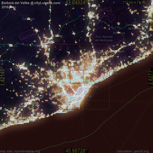
Analysis of Barberà del Vallès night lights 2016
Square area 10x10 km:
 38.95%
90-99
35.54%80-89
7.31%70-79
15.48%60-69
2.72%50-59
0%40-49
0%30-39
0%20-29
0%10-19
0%0-9
0%Square area 50x50 km:
11.54%90-99
10.61%80-89
4.82%70-79
5.93%60-69
8.44%50-59
6.51%40-49
4.52%30-39
4.92%20-29
9%10-19
10.6%0-9
23.1%Clear (daylight) street map image can be seen on geolist.org.
Map coordinates:
42° 2' 24.9" North, 1° 25' 17.2" East
41° 30' 57.2" North, 2° 7' 28.5" East
40° 59' 14.2" North, 2° 49' 39.7" East
Some cities around Barberà del Vallès sort by population:
• Sabadell
3.3 km =2.1 mi,  337°
337°
• Sant Cugat del Vallès
6 km =3.7 mi,  212°
212°
• Cerdanyola del Vallès
3.1 km =1.9 mi,  153°
153°
• Ripollet
3.5 km =2.2 mi,  127°
127°
• Santa Perpètua de Mogoda
5.3 km =3.3 mi,  68°
68°
• Sant Quirze del Vallès
3.9 km =2.4 mi,  299°
299°
• La Llagosta
5.7 km =3.5 mi,  91°
91°
• Polinyà
4.3 km =2.7 mi,  29°
29°
3109804 (p: 31,144)
Sources (retrieved 2019-11-25):
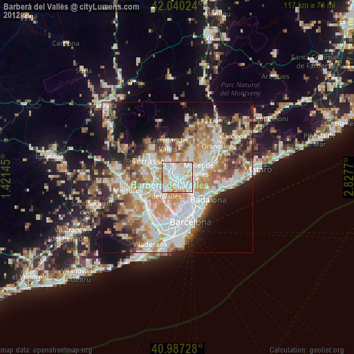
» Earth at Night: Flat Maps 2012, 2016