La Llagosta night lights from space
Night Light of La Llagosta (Catalonia) from space (Spain) Src. Average luminocity for 10x10km area is 86.5051% and for 50x50km: 45.3647%.
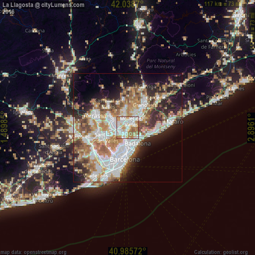
Analysis of La Llagosta night lights 2016
Square area 10x10 km:
 27.89%
90-99
27.38%80-89
9.52%70-79
15.99%60-69
16.16%50-59
3.06%40-49
0%30-39
0%20-29
0%10-19
0%0-9
0%Square area 50x50 km:
11.35%90-99
10.43%80-89
4.4%70-79
5.58%60-69
8.21%50-59
6.31%40-49
4.1%30-39
4.61%20-29
7.92%10-19
10.16%0-9
26.93%Clear (daylight) street map image can be seen on geolist.org.
Map coordinates:
42° 2' 19.3" North, 1° 29' 23.5" East
41° 30' 51.7" North, 2° 11' 34.7" East
40° 59' 8.6" North, 2° 53' 46" East
Some cities around La Llagosta sort by population:
• Cerdanyola del Vallès
5.1 km =3.2 mi,  239°
239°
• Mollet del Vallès
3.3 km =2.1 mi,  30°
30°
• Ripollet
3.5 km =2.2 mi, 236°
• Montcada i Reixac
3.5 km =2.2 mi,  193°
193°
• Barberà del Vallès
5.7 km =3.5 mi,  271°
271°
• Santa Perpètua de Mogoda
2.3 km =1.4 mi,  339°
339°
• Montmeló
5.7 km =3.5 mi,  45°
45°
• Polinyà
5.3 km =3.3 mi,  317°
317°
3119531 (p: 13,820)
Sources (retrieved 2019-11-25):
» Earth at Night: Flat Maps 2012, 2016