Cerdanyola del Vallès night lights from space
Night Light of Cerdanyola del Vallès (Catalonia) from space (Spain) Src. Average luminocity for 10x10km area is 88.6446% and for 50x50km: 47.9092%.
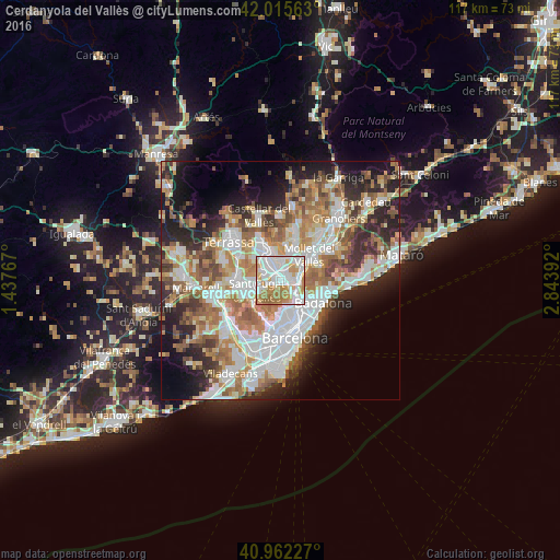
Analysis of Cerdanyola del Vallès night lights 2016
Square area 10x10 km:
 31.8%
31.8%90-99
30.61%80-89
7.65%70-79
14.12%60-69
14.46%50-59
1.36%40-49
0%30-39
0%20-29
0%10-19
0%0-9
0%Square area 50x50 km:
11.84%90-99
10.85%80-89
4.81%70-79
5.99%60-69
8.57%50-59
6.8%40-49
4.4%30-39
4.97%20-29
8.94%10-19
10.25%0-9
22.57%Clear (daylight) street map image can be seen on geolist.org.
Map coordinates:
42° 0' 56.3" North, 1° 26' 15.6" East
41° 29' 27.9" North, 2° 8' 26.8" East
40° 57' 44.2" North, 2° 50' 38.1" East
Some cities around Cerdanyola del Vallès sort by population:
• Sant Cugat del Vallès
5.1 km =3.2 mi,  243°
243°
• Ripollet
1.5 km =0.9 mi,  65°
65°
• Montcada i Reixac
3.6 km =2.2 mi,  103°
103°
• Barberà del Vallès
3.1 km =1.9 mi,  333°
333°
• les Roquetes
5.6 km =3.5 mi,  149°
149°
• La Llagosta
5.1 km =3.2 mi,  59°
59°
• Ciutat Meridiana
4.4 km =2.7 mi,  139°
139°
• Canyelles
5.5 km =3.4 mi,  159°
159°
3109402 (p: 58,747)
Sources (retrieved 2019-11-25):
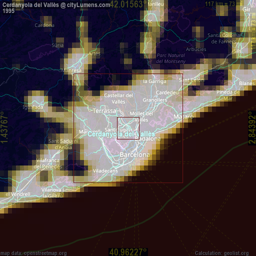
» NASA, Earths city lights 1995
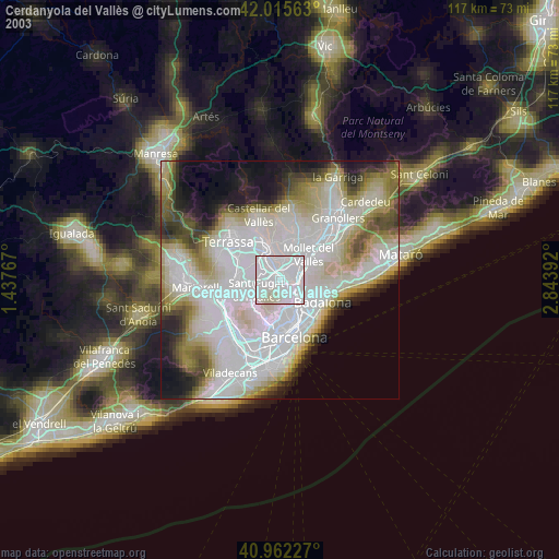
» NASA city lights 2003
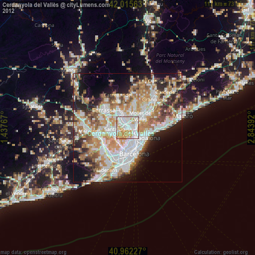
» Earth at Night: Flat Maps 2012, 2016